Using satellite technology and digital innovation, the United Nations Development Programme, through its Sustainable Palm Oil Initiative, in partnership with the Bogor Agricultural University (IPB), has built an Android-based digital system to address challenges in developing a land cover monitoring system.
The INA- Alert application allows users to get real time accurate information and it works in conjunction with the WebGIS Ecosystem, developed by Bogor Agricultural University (IPB) and the National Aeronautics and Space Agency (LAPAN).
During a recent public consultation held on 28 and 29 December 2020, the team conducted training as well as testing the system in one of Indonesia’s sustainable palm oil producing area in Pelalawan District of Riau Province.
The public consultation gathered input from the parties involved to help improve the algorithm and also to expand knowledge, awareness and ability of the parties in utilizing the system, according to the Head of the Environmental Agency (DLH), Pelalawan District, Eko Novitra.
The Environmental Agency (Dinas Lingkungan Hidup) of Pelalawan District is a key partner in the training.
“The availability of data on the geographical distribution of plantations area and land-cover monitoring system is crucial to supporting the formulation of the environmental performance index and to follow up on the palm oil rejuvenation program in Pelalawan District”, Eko said.
According to Dr. Yudi Setiawan from IPB University, the system aims tor apidly detect real time changes of land cover and identfy the spatial distribution data of several strategic commodities, such as palm oil and rubber,and develop the WebGIS platform as a too to monitor changes to land cover. The application functions on the Android platform.
“Pelalawan District is one of our target areas to promote this programme in addition to Sintang and Tapanuli Selatan Districts. UNDP chose these districts as priority areas in to detect deforestation rates and gather information on ,land cover”, Dr Yudi added.
The data used in this monitoring system comes from satellite image processing at LAPAN, using algorithms aimed at detecting land cover changes. The team also utilized the Google Earth Engine cloud computing by using machine learning to produce data every eight-days to predict land cover for strategic commodities nationwide. The data also comes from the Ministry of Environment and Forestry’s (MoEF) database.
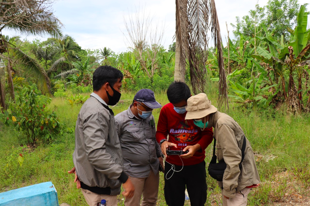
The public consultation continued with the field trial of the INA-Alert android application to validate, verify, and detect land cover changes in plantation and forest areas by transect-walking the local rubber plantations and rice fields in three sub-districts of Pelalawan. All activities in collaboration with IPB are expected to contribute to the SPOI project targeted output to introduce and implement a cost-effective monitoring system within target landscapes. The land use change monitoring system is utilized to ensure responsible land-use arrangement for sustainable development and reducing deforestation for commodity production.
The overall goal is to support MoEF oversee the dynamics of land cover in Indonesia especially those that caused by agriculture extensification. It is hoped that this support can be the foundation to build responsive policies in sustainable land and forest resource management in Indonesia.
-
Writing by Agus Hekso Proklamanto
Edited by Ranjit Jose and Tomi Soetjipto
Blog reposted from: https://www.id.undp.org/content/indonesia/en/home/presscenter/articles/2...

