Aller au contenu principal

page search

IssuesgéomètreLandLibrary Resource
There are 1, 397 content items of different types and languages related to géomètre on the Land Portal.

géomètre

AGROVOC URI:

Displaying 1153 - 1164 of 1333

Land Titles Registration Act 2008.

Legislation
Samoa
Océanie

This Act provides rules for the registration of title or other interests in land and related matters and provides for the form of transfer of title in land or other interest in land such as mortgages, caveats, leases and easements.There shall continue to be a Registrar of Land who shall be the Chief Executive Officer responsible for the administration of this Act. The Registrar may delegate the Registrar’s powers and functions to the Assistant Registrar of Land.

Law No. 2200

Legislation
Kazakhstan
Fédération de Russie
Asie central

This Law consists of 5 Chapters that contain 26 articles. Chapter 1 lays down the general provisions. Chapter 2 lists the types of activity that are subject to obligatory licensing. Chapter 3 determines licensing for export and import of commodities (produce service). Chapter 4establishes the modalities of issuing licences. Chapter 5 establishes liability for the infringement of the legislation currently in force on licensing.

Law No. 471-1 of 1999 on amendments and additions to the Law on licensing.

Legislation
Kazakhstan
Fédération de Russie
Asie central

Point 26 of the paragraph 1 of the Article 9 is supplemented with the expression "land survey/mapping practices". Point 45 of the paragraph 1 of the Article 9 acquires a new wording. It reads as follows "formal acceptance, storage and processing of cereals and the by-products of their processing at grain-elevators". Paragraph 1 of the Article 12 is supplemented with the following sentence: "Export and import of some commodities (produce and service) are subject to obligatory licensing".

Amends: Law No. 2200 (1995-04-17)

Governmental Decree No. 137 validating the Regulation on State land cadastre.

Regulations
Fédération de Russie
Kirghizistan
Asie
Asie central

This Governmental Decree establishes that the scope of land cadastre shall be to provide state bodies of all levels, natural and legal persons with the informationrelated to land areas and land quality located within the boundaries of urban areas, local government, districts and at the national level.

Land Survey Ordinance

Legislation
Novembre, 1957
Tanzania

An Ordinance to consolidate and amend the Law relating to Land Survey and Licensing of Land Surveyors to amend the Penal Code, and for matters incidental thereto and connected therewith. 

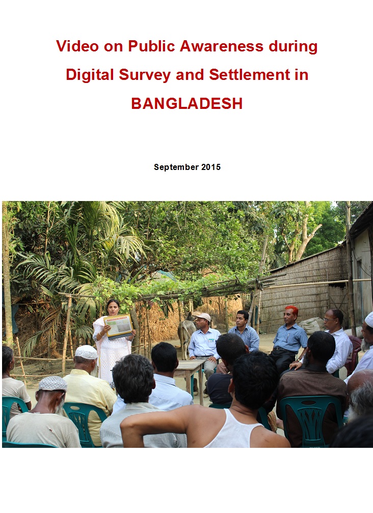
Video documentary on public awareness activities of Digital land Survey and Settlement

Videos
Février, 2015
Bangladesh

Uttaran (www.uttaran.net) is a local organisation (Bangladesh) working with vulnerable landowners i.e. women, widow, indigenous, minority and landless people to promote access to land. Uttaran is implementing a project titled, Sustainable Access to Land Equality-SALE' with support of European Union. SALE is the civil society component of overall access to land project that is lead by Department of Land Records and Surveys (DLRS) and Ministry of Land in Bangladesh.

Animated movie on Integrated Digital Land Records Systems -IDLRS in Bangladesh

Videos
Août, 2016
Bangladesh

Uttaran (www.uttaran.net) is a local organisation (Bangladesh) working with vulnerable landowners i.e. women, widow, indigenous, minority and landless people to promote access to land. Uttaran is implementing a project titled, Sustainable Access to Land Equality-SALE' with support of European Union. SALE is the civil society component of overall access to land project that is lead by Department of Land Records and Surveys (DLRS) and Ministry of Land in Bangladesh.

LDGI Survey

Journal Articles & Books
Reports & Research
Janvier, 2016
Kenya

Public land is a resource that should be effectively managed in the public’s best interest in line with provisions of the Constitutions of Kenya and the Land Act. The management framework governing land use and development decisions on public land should ensure protection and sustainable management of the land. Despite these provisions in law, recent media reports point toresurgenceof public land grab. The Land Development and Governance Institute commissioned this research study to establish the status of the public land management in Kenya.

AN EVALUATION OF THE CADASTRAL SYSTEM IN KENYA AND A STRATEGY FOR ITS MODERNIZATION

Reports & Research
Juillet, 2013
Kenya

The Cadastral system in Kenya was established in 1903 to support land alienation for the white settlers who had come into the country in the early part of the 20th Century. In the last hundred years, the system has remained more or less the same, where land records are kept in paper format and majority of operations are carried out on a manual basis. The lack of a modern cadastral system has contributed to problems in land administration in the country.