Aller au contenu principal

page search

Issuesutilisation des terresLandLibrary Resource
There are 9, 839 content items of different types and languages related to utilisation des terres on the Land Portal.
Displaying 2965 - 2976 of 4598

Land Use and Land Cover Changes and Their Effects on the Landscape of Abaya-Chamo Basin, Southern Ethiopia

Peer-reviewed publication

This study uses a combination of remote sensing data, field interviews and observations, and landscape indices to examine the dynamics of land use and land cover (LULC), identify their driving forces, and analyze their effects on the landscape of Abaya-Chamo Basin (ACB) between 1985, 1995, and 2010. The results reveal that the landscape of ACB has changed considerably during the past 25 years between 1985 and 2010. The main changes observed imply a rapid reduction in shrubland (28.82%) and natural grassland (33.13%), and an increase in arable land (59.15%).

Effect of Land Use Change on Soil Carbon Storage over the Last 40 Years in the Shi Yang River Basin, China

Peer-reviewed publication

Accounting for one quarter of China’s land area, the endorheic Shiyang River basin is a vast semi-arid to arid region in China’s northwest. Exploring the impact of changes in land use on this arid area’s carbon budget under global warming is a key component to global climate change research. Variation in the region’s soil carbon storage due to land use changes occurring between 1973 and 2012 was estimated. The results show that land use change has a significant impact on the soil carbon budget, with soil carbon storage having decreased by 3.89 Tg between 1973 and 2012.

Land Use as a Motivation for Railway Trespassing: Experience from the Czech Republic

Peer-reviewed publication
République tchèque

Railway trespassing is a very risky but common behaviour, resulting in about 200 casualties annually in the Czech Republic. This study describes the formation of 27 selected risk localities with frequent occurrence of trespassing in the regions of southern, central and northern Moravia. To be able to describe the process, an evaluation of the development of land use was conducted within a wide spatial context of each spot. The evaluation was focused on functional use of built-up areas (collective and individual housing, industrial areas, shopping and services, recreational areas, etc.).

Transferring Landscape Character Assessment from the UK to the Eastern Mediterranean: Challenges and Perspectives

Peer-reviewed publication
Chypre

Landscape character assessment (LCA) has a significant contribution to make as a spatial framework for the emerging concept of ‘multi-functional landscapes’, a landscape providing a range of functions, services, and human-derived benefits. The paper reviews the development of LCA in Northwest Europe with a brief description of more recent LCA projects in a Mediterranean context. This is followed by a comparative description of the Living Landscapes approach developed in the UK as applied to Cyprus.

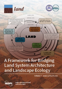
A Land Systems Science Framework for Bridging Land System Architecture and Landscape Ecology: A Case Study from the Southern High Plains

Peer-reviewed publication

Resource-use decisions affect the ecological and human components of the coupled human and natural system (CHANS), but a critique of some frameworks is that they do not address the complexity and tradeoffs within and between the two systems. Land system architecture (LA) was suggested to account for these tradeoffs at multiple levels/scales. LA and landscape ecology (LE) focus on landscape structure (i.e., composition and configuration of land-use and land-cover change [LULCC]) and the processes (social-ecological) resulting from and shaping LULCC.

Improving Object-Based Land Use/Cover Classification from Medium Resolution Imagery by Markov Chain Geostatistical Post-Classification

Peer-reviewed publication

Land use/land cover maps derived from remotely sensed imagery are often insufficient in quality for some quantitative application purposes due to a variety of reasons such as spectral confusion. Although object-based classification has some advantages over pixel-based classification in identifying relatively homogeneous land use/cover areas from medium resolution remotely sensed images, the classification accuracy is usually still relatively low.

Quantifying Land Use in Past Societies from Cultural Practice and Archaeological Data

Peer-reviewed publication

Quantitative reconstructions of past land use facilitate comparisons between livelihoods in space and time. However, comparison between different types of land use strategies is challenging as land use has a multitude of expressions and intensities. The quantitative method presented here facilitates the exploration and synthetization of uneven archaeological and textual evidence from past societies.

Causes of informal settlements in Ekurhulen metropolitan municipality: An Exploration

Reports & Research
Août, 2017
Afrique du Sud

This article aims to explore the causes of informal settlements in Ekurhuleni Metropolitan Municipality (EMM). The article strongly challenges the view that the cause of informal settlements in EMM and other parts of South Africa is predominantly the apartheid government and agrees with literature which provides evidence that to a larger extent, the present government, not the apartheid government, is one of the dominant causes of informal settlements.

ATC141126: Report of the SC Land on oversight visit to entities of Departments of Mineral Resources & Agriculture, Forestry & Fisheries, dated 25 November 2014

Legislation & Policies
Novembre, 2014
Afrique du Sud

The Select Committee on Land and Mineral Resources having conducted oversight at the Council of Geosciences (CGS), the Agricultural Research Council (ARC) and Onderstepoort Biological Products (OBP), from 21 – 22 October 2014 reports as follows:

1. Background and Introduction

Expropriation Bill [B4-2015]: public hearings with Deputy Minister in attendance Day 2

Legislation & Policies
Juillet, 2015
Afrique du Sud

Agri SA supported orderly land reform – equitable land distribution is a prerequisite for rural stability and inclusive rural development. Agri-SA believed that expropriation should only be used as a last resort where negotiations fail. There needed to be a clear purpose for expropriation. Compensation should never be dependent on the state’s ability to pay. The land owner should always be afforded recourse to the courts to contest both the merits of the expropriation and the compensation amount.

One Woman, One Hectare of Land CGE Report; Rural Development & Land Reform Budget Review & Recommendations Report

Legislation & Policies
Octobre, 2015
Afrique du Sud

The Commission for Gender Equality presented on its proposed campaign called One Woman, One Hectare of Land’. The campaign aims to mainstream gender equality, for it was proposed that the State should allocate one hectare of land, for the growing of food, to the poorest rural female-run households. It was believed that this would help alleviate poverty and empower rural women. It was pointed out that where women had land, their families generally were better nourished, better educated and able to move on.

Department of Rural Development and Land Reform; Ingonyama Trust; Commission on Restitution of Land Rights on their 2014/15 Annual Reports; Audit outcomes by Auditor-General

Legislation & Policies
Octobre, 2015
Afrique du Sud

A representative of the Auditor-General South Africa (AGSA) briefed the Committee on the audit outcomes and expenditure patters in the rural development portfolio for the 2014/2015 financial year. The quality of submitted financial statements for the Agricultural Land Holding Account (ALHA) was good but needed improvement. The quality of submitted performance reports for Ingonyama Trust Board (ITB) was good but required intervention from the Department of Rural Development and Land Reform (DRDLR or the Department).