Aller au contenu principal

page search

Displaying 313 - 324 of 6749

Access to Land Influencing the Urban Development of Egypt

Journal Articles & Books
Décembre, 2018
Egypt

The paper seeks to assess the impact of access to the land of Egypt on urban development in an attempt to identify policies and laws that can be categorized as a catalyst in urban conflict A systematicreview of Data on land tenure environment of Egypt land access land governance and tenure security the actors involved in these processes their roles the land tenure related challenges they face and measures that can be taken to address these challenges was collected at country level In the context of Egypt Access to land is deemed with obstacles confronting beneficiaries and legal procedures

Economics of land degradation in Niger

Peer-reviewed publication
Décembre, 2018
Afrique occidentale
Afrique sub-saharienne
Afrique
Niger

Land degradation poses daunting challenges to Niger and the country has designed several policies and strategies for combatting it. Building on work past studies, this study uses new satellite data which have higher resolution and run for longer time – thus capturing the longterm land management dynamics. This study also uses an improved cost of land degradation model which nets out benefits from land improvement as well analysing the impacts of land degradation on food and nutrition security.

Spatial Data Structure and Functionalities for 3D Land Management System Implementation: Israel Case Study

Journal Articles & Books
Décembre, 2018

With the existence of mature technologies and modern urban planning necessities, there is a growing public demand to improve the efficiency and transparency of government administrations. This includes the formation of a comprehensive modern spatial land management (cadastre) system having the capacity to handle various types of data in a uniform way—above-terrain and below-terrain—enabling the utilization of land and space for various complex entities.

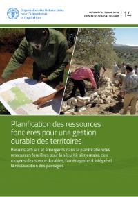
Planification des ressources foncières pour une gestion durable des territoires

Journal Articles & Books
Décembre, 2018
Bosnia and Herzegovina
Philippines
Tajikistan
Italy
Bolivia
Canada
India

Ce document de travail entend parcourir l’évolution historique et faire un état des lieux des concepts et des outils à la base de l’évaluation des terres et de l’aménagement du territoire pour la gestion des ressources foncières et des paysages, et proposer par là-même des recommandations pour des actions futures.

Prioritization of land consolidation and exchange works in villages of eastern Poland using example of Frampol commune

Conference Papers & Reports
Décembre, 2018
Poland
Latvia

Land consolidation and land exchange are two important measures that can be used to improve the spatial structure of farm holdings. Unfortunately, land cannot be consolidated and exchanged in all villages of a given area simultaneously, due to economic, technical, and social considerations. Instead, an analysis has to be carried out, which allows one to rank the villages with regard to how urgently they need consolidation and exchange of land.

Proposals for classification and evaluation of land degradation in Latvia

Policy Papers & Briefs
Décembre, 2018
Latvia

Land degradation is one of the most pressing problems ensuring sustainable use of land. In order to provide a clear understanding of land degradation and its risks, as well as to implement unified measures for prevention of land degradation in Latvia, the Land Management Law came into force in 2015. It individually defines the concepts of land and soil degradation, thus separating them from each other, as well as clarifying the term “degraded territory”.

Use of geospatial analysis methods in land management and cadastre

Policy Papers & Briefs
Décembre, 2018
Latvia
Belarus

The possibilities of using the geospatial analysis methods for visualizing land monitoring data and modelling the spatial distribution of the main agrochemical soil indicators are discussed in the article. The research was conducted within the limits of land use of RUP “Uchkhoz BGSHA” (Republic of Belarus, Mogilev region, Goretsky district). The total area of the surveyed territory was 3187.0 hectares. The geospatial analysis of the spatial distribution of humus, mobile phosphorus, mobile potassium and pHKCl was carried out using the Geostatistical Analyst module of the ArcGIS software.

Research of compatibility and systemity of land management terminology

Policy Papers & Briefs
Décembre, 2018
Latvia
Ukraine

The analysis results of common terms in land management and their interpretations in normative-legal acts of Ukraine are presented. It have been established collisions and significant differences in the wording of even such common terms as a land parcel, a boundary of land parcel, a size of land parcel, etc. The purpose of the study is to identify collisions and contradictions of some key terms used in land surveying and geodetic works, as well as development of concrete proposals for improving and perfection the relevant terms.

The analysis of agricultural land patterns of the Altai Region

Journal Articles & Books
Décembre, 2018
Russia

In the structure of the land fund of the Altai Region the category of agricultural lands is the most extensive, it is more than 11.5 million hectares. More than 6.1 million hectares belong to individual citizens. There are more than 5 million hectares of state and municipal ownership. The rest of the lands are owned by legal entities. There were analyzed the natural and climatic conditions of the land fund of the Altai Region and its patterns in the natural subzones.

Environmental policy and land management in rural areas of Ukraine

Policy Papers & Briefs
Décembre, 2018
Latvia
Ukraine

The research studies the issue of ecological stability of rural territories that is the most important component of the national environmental policy of Ukraine. A special attention is paid to degradation of arable lands as the main ecological problem of land management. On the example of Lviv region, the authors calculated the index of ecological nonconformity of current use of arable lands, proving a considerable excess of permissible ploughing of lands in the region.