système d'information géographique related Event | Land Portal
Il y a 880 éléments de contenu liés à système d'information géographique sur le Land Portal.

système d'information géographique

An information system for capturing, storing, integrating, analyzing and displaying geospatial data.

Affichez 1 - 12 de 23
26 mars 2024 to 2 avril 2024
Global

NASA’s Applied Remote Sensing Training Program (ARSET) has opened a new open, online webinar series: Introduction to Lightning Observations and Applications. This three-part, introductory training focuses on global and regional lightning data products that can be applied to disaster risk preparedness.

As the intensity and frequency of extreme weather events are likely to increase due to climate change impacts, lightning activity will likely increase as well, causing more power outages, increased risks of wildfire ignition, and increased numbers of injuries and fatalities. Therefore, information about lightning activity is critical for better preparedness against these disasters.

5 mars 2024 to 19 mars 2024
Global

NASA’s Applied Remote Sensing Training Program (ARSET) has opened a new open, online webinar series: Large Scale Applications of Machine Learning using Remote Sensing for Building Agriculture Solutions. Remote sensing data is becoming crucial to solve some of the most important environmental problems, especially pertaining to agricultural applications and food security. Participants will become familiar with data format and quality considerations, tools, and techniques to process remote sensing imagery at large scale from publicly available satellite sources, using cloud tools such as AWS S3, Databricks, and Parquet. Additionally, participants will learn how to analyze and train machine learning models for classification using this large source of data to solve environmental problems with a focus on agriculture. 


Land Rights for Sustainable Development - The Role of Data
17 janvier 2024

Emplacement

European Commission Brussels
Belgique
BE
Global

Having secure land tenure, ensuring people's confidence in accessing, controlling and utilizing their land, is crucial for promoting sustainable land management practices. It also plays a key role in building resilience against the impacts of climate change, including extreme weather events, rising sea levels, and increased desertification due to higher temperatures.

Organizers: 
International Land Coalition
Land Portal Foundation
Land Matrix
Prindex
9 novembre 2023

Emplacement

Novotel Paris 17
France
FR
Europe

Le Comité de Liaison des Géomètres Européens (CLGE) et l’Ordre des géomètres-experts (OGE), ont le plaisir de convier le réseau francophone FGF à la IXème Conférence du Géomètre Européen sur le thème « Le rôle du géomètre dans la gestion des catastrophes ».

Organizers: 
Institut de recherche pour le développement
3 octobre 2023 to 10 octobre 2023
Global

NASA’s Applied Remote Sensing Training Program (ARSET) has opened a new open, online, intermediate webinar series: Transforming Earth Observation (EO) Data into Building Infrastructure Data Sets for Disaster Risk Modeling. This three-part training, presented in English and Spanish, is open to the public and will cover the basics of natural hazard risk modeling and exposure development with a focus on fusing data from multiple datasets expressly for the purposes of risk assessment.  We will also present examples applying the techniques to applications related to flood risk assessment, climate adaptation, and earthquake modeling.

28 septembre 2023
Afrique
Global

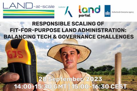
Rejoignez-nous pour un webinaire stimulant qui explore les défis et les orientations futures pour étendre l'administration foncière adaptée ("Fit-For-Purpose Land Administration", FFPLA) sur la base d'expériences sur le terrain. Les approches FFPLA sont largement reconnues et applaudies pour être plus abordables, plus rapides et plus flexibles (en termes d'identification spatiale) que les méthodes conventionnelles d'administration foncière.  

Organizers: 
Land Portal Foundation
Netherlands Enterprise & Development Agency
18 juillet 2023 to 25 juillet 2023
Global

NASA’s Applied Remote Sensing Training Program (ARSET) has opened a new open, online webinar series: Monitoring Water Quality of Inland Lakes using Remote Sensing. This advanced-level training will focus on using remote sensing observations from Landsat 8 and 9, Sentinel-2, and Sentinel-3 for assessing water quality parameters, including chlorophyll-a concentration, turbidity, and Total Suspended Solids (TSS) in inland lakes. This training will also highlight the importance of in situ measurements of these parameters, coincident with satellite observations, in developing methodologies for operational water quality monitoring.

Transforming Africa Into a Powerhouse of the Future
22 juin 2023
Afrique
Afrique sub-saharienne
Afrique australe

Ce webinaire vise à renforcer la capacité des chercheurs et des praticiens à travers l'Afrique à mieux comprendre les approches durables de la gouvernance des données foncières. Le webinaire soulignera l'importance d'une bonne gouvernance des données foncières pour améliorer les droits de propriété et permettre des services gouvernementaux plus efficaces.

Organizers: 
Land Portal Foundation
German Federal Ministry for Economic Cooperation and Development
Deutsche Gesellschaft für Internationale Zusammenarbeit (GIZ) GmbH
The Network of Excellence on Land Governance in Africa
17 mai 2023 to 31 mai 2023
États-Unis d'Amérique
Global

NASA’s Applied Remote Sensing Training Program (ARSET) has opened a new open, online webinar series: Application of NASA SPoRT-Land Information System (SPoRT-LIS) Soil Moisture Data for Drought. This 3-part webinar series is focused on the introduction of the NASA Land Information System (LIS) output of soil moisture at various depths for drought analysis and monitoring. Examples from operational applications as well as practice exercises (for using LIS data for drought monitoring) will be included in this course. Access to the SPoRT-LIS products via online viewer, in GIS formats, and GIS-based display tools, will also be included. Moreover, self-paced microlessons will be available to help users confirm their understanding and improve their skill via homework lessons between live sessions.

20 avril 2023 to 4 mai 2023
Global

NASA’s Applied Remote Sensing Training Program (ARSET) has opened a new online introductory webinar series: Fundamentals of Machine Learning for Earth Science. This three-part training, presented in English and Spanish, is open to the public and will provide attendees an overview of machine learning in regards to Earth Science, and how to apply these algorithms and techniques to remote sensing data in a meaningful way. Attendees will also be provided with end-to-end case study examples for generating a simple random forest model for land cover classification from optical remote sensing. We will also present additional case studies to apply the presented workflows using additional NASA data.


4 avril 2023 to 13 avril 2023
Global

NASA’s Applied Remote Sensing Training Program (ARSET) has opened a new online advanced webinar series: Crop Mapping using Synthetic Aperture Radar (SAR) and Optical Remote Sensing. This three-part training, presented in English and Spanish, is open to the public and builds on previous ARSET agricultural trainings. Here we present more advanced radar remote sensing techniques using polarimetry and a canopy structure dynamic model to monitor crop growth. The training will also cover methods that use machine learning methods to classify crop type using a time series of Sentinel-1 & Sentinel-2 imagery. This series will include practical exercises using the Sentinel Application Platform (SNAP) and Python code written in Python Jupyter Notebooks, a web-based interactive development environment for scientific computing and machine learning.

FIG Congress 2023
28 mai 2023 to 1 juin 2023
Global

Lorsque notre communauté mondiale s'unit, l'énergie est inarrêtable. C'est pourquoi la FIG et les organisateurs locaux, NSPS, sont ravis de vous inviter à la semaine de travail FIG 2023. Attendez-vous à une conférence passionnante d'une semaine qui rassemblera la communauté internationale des professionnels de la topographie et de l'espace pour vivre un mélange de sessions techniques et d'ateliers intéressants, une exposition commerciale et une variété d'événements parallèles et de fonctions sociales. 

Organizers: 
International Federation of Surveyors (FIG)

Blogues

Événements

Organisations

Belgeo est la seule revue scientifique nationale de géographie en Belgique. Au-delà des articles thématiques ou de réflexion, la revue a pour objectif de couvrir les grandes questions géographiques, les problèmes européens et mondiaux ainsi que les problèmes nationaux.  Belgeo permet également la propagation des résultats de recherches menées par des géographes belges, souvent à la jonction des approches anglo-saxonne et latine, et ouvre ses pages aux derniers développements tant en géographie humaine que physique.

MOTTO

The Dedan Kimathi University of Technology motto is: “Better Life through Technology”.


VISION STATEMENT

To be a Premier Technological University Excelling in Quality Education, Research, and Technology Transfer for National Development.


MISSION STATEMENT

Deloitte Touche Tohmatsu Limited, commonly referred to as Deloitte, is a multinational professional services network.[6] Deloitte is one of the "Big Four" accounting organizations and the largest professional services network in the world by revenue and number of professionals with headquarters in London, United Kingdom.[7]

Environmental Systems Research Institute (ESRI)

We are the global market leader in GIS, helping customers get results since 1969.

Esri was founded to help solve some of the world’s most difficult problems. We do so by supporting our users’ important work with a commitment to science, sustainability, community, education, research, and positive change.

Today, Esri software is deployed in more than 350,000 organizations, including the world’s largest cities and most national governments.

 European Space Agency logo

The European Space Agency (ESA) is Europe’s gateway to space. Its mission is to shape the development of Europe’s space capability and ensure that investment in space continues to deliver benefits to the citizens of Europe and the world.

ESA is an international organisation with 22 Member States. By coordinating the financial and intellectual resources of its members, it can undertake programmes and activities far beyond the scope of any single European country.

What does ESA do?

ITC is the University of Twente’s Faculty of Geo-Information Science and Earth Observation.

Our mission is to develop capacity, particularly in less developed countries, and to utilize geospatial solutions to deal with national and global problems.

Our vision is that spatial solutions will play an increasingly important role in meeting many of mankind’s complex challenges (often wicked problems), such as climate change, population growth, and related claims for sufficient and secure food, water, energy, health, land and housing provision.

Forest Inform Pty Ltd provides "Land Logic Services" that combine government agencies' and stakeholders’ decision rules with accurate spatial data to resolve forest land use conflicts, integrate regional development, prepare conservation plans, and Reduce Emissions from Deforestation and Forest Degradation (REDD+).

Geo-Informatie Nederland logo

GIN is an interactive meeting place and is an open knowledge network for everyone who is professionally involved with geographic information. GIN organizes activities and encourages and facilitates sharing and transferring knowledge of its members in development of all members and to strengthen the position of the field of geo-information in society.


The subsequent strategic goals are:


Geoforum journal logo

Geoforum is a leading international, inter-disciplinary journal publishing innovative research and commentary in human geography and related fields. It is global in outlook and integrative in approach. The broad focus of Geoforum is the organisation of economicpoliticalsocial and environmental systems through space and over time.

Dernières nouvelles

SOLIndex Dashboard: Consultancy
2 février 2024
Global

La Fondation Land Portal recrute un consultant ou une entreprise qui sera responsable de la recherche, du conseil et de l'aménagement d'un tableau de bord de données foncières viable permettant aux utilisateurs de visualiser et d'analyser les données disponibles.

7 décembre 2021
Afrique occidentale
Togo

 Les pays membres de l'Union économique et monétaire ouest-africaine (UEMOA), se préparent à se doter d’un système d’information foncière en zone urbaine. Et selon les informations, le Togo, suite à la réunion des Ministres chargés de l'urbanisme, de l’habitat et du foncier urbain dans la zone, tenue à Dakar fin novembre, va apporter son expertise à l’espace communautaire en ce sens.

Partagez cette page