Aller au contenu principal

page search

There are 1, 643 content items of different types and languages related to données ouvertes on the Land Portal.

données ouvertes

AGROVOC URI:

Displaying 25 - 36 of 43

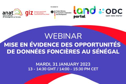
Découvrir les opportunités de données foncières : Les cas du Sénégal et de la Namibie
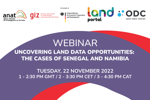
22 Novembre 2022

Le webinaire partagera les derniers résultats du pilote de mise en œuvre du Guide Open Up au Sénégal et de la recherche SOLI en Namibie. Nous poserons et répondrons à des questions pressantes concernant l'intérêt et la maturité des données ouvertes dans les deux pays et spécifiquement dans le secteur foncier. 

Land Portal Foundation
Deutsche Gesellschaft für Internationale Zusammenarbeit (GIZ) GmbH
Government of Senegal
Open Data Charter

Mise en évidence des opportunités de données foncières au Sénégal

30 Janvier 2023

Le webinaire :

  • Partager les derniers résultats du projet pilote de mise en œuvre du Guide Open Up au Sénégal et les conclusions du rapport SOLI Sénégal

  • Poser et discuter des questions concernant l'intérêt et la maturité des données ouvertes au Sénégal en ce qui concerne le foncier

  • Entendre les points de vue du gouvernement du Sénégal, des donateurs, et des membres de la communauté locale, en utilisant des études de cas spécifiques sur les données et les initiatives foncières

Land Portal Foundation
Deutsche Gesellschaft für Internationale Zusammenarbeit (GIZ) GmbH
Government of Senegal

Crop Mapping using Synthetic Aperture Radar (SAR) and Optical Remote Sensing

03 Avril 2023 - 12 Avril 2023

NASA’s Applied Remote Sensing Training Program (ARSET) has opened a new online advanced webinar series: Crop Mapping using Synthetic Aperture Radar (SAR) and Optical Remote Sensing. This three-part training, presented in English and Spanish, is open to the public and builds on previous ARSET agricultural trainings. Here we present more advanced radar remote sensing techniques using polarimetry and a canopy structure dynamic model to monitor crop growth. The training will also cover methods that use machine learning methods to classify crop type using a time series of Sentinel-1 & Sentinel-2 imagery. This series will include practical exercises using the Sentinel Application Platform (SNAP) and Python code written in Python Jupyter Notebooks, a web-based interactive development environment for scientific computing and machine learning.

Reprendre les données : La souveraineté des femmes sur les données foncières

29 Mars 2023

Le thème de la Journée internationale de la femme de cette année est "DigitALL : l'innovation et la technologie au service de l'égalité entre les femmes et les hommes".  La journée vise à célébrer les femmes et les filles qui se font les championnes de l'avancement de la technologie transformatrice et de l'éducation numérique. Elle explorera également l'impact du fossé numérique entre les hommes et les femmes sur l'aggravation des inégalités économiques et sociales. 

Land Portal Foundation
Ford Foundation
Thomson Reuters Foundation
The Tenure Facility

Fundamentals of Machine Learning for Earth Science

19 Avril 2023 - 03 Mai 2023

NASA’s Applied Remote Sensing Training Program (ARSET) has opened a new online introductory webinar series: Fundamentals of Machine Learning for Earth Science. This three-part training, presented in English and Spanish, is open to the public and will provide attendees an overview of machine learning in regards to Earth Science, and how to apply these algorithms and techniques to remote sensing data in a meaningful way. Attendees will also be provided with end-to-end case study examples for generating a simple random forest model for land cover classification from optical remote sensing. We will also present additional case studies to apply the presented workflows using additional NASA data.


Droits fonciers autochtones et biodiversité COP15 : six mois après

24 Mai 2023

Après deux semaines de négociations tendues, la récente conférence des Nations unies sur la biodiversité (COP15) s'est achevée sur un accord historique destiné à guider l'action mondiale en faveur de la nature jusqu'en 2030. Le cadre mondial pour la biodiversité (CMB) de Kunming-Montréal comprend des mesures concrètes pour stopper et inverser la perte de la nature, notamment en plaçant 30 % de la planète et 30 % des écosystèmes dégradés sous protection d'ici à 2030.

Land Portal Foundation
Ford Foundation
Thomson Reuters Foundation
The Tenure Facility

Assessing the Impacts of Fires on Watershed Health

05 Juillet 2023 - 12 Juillet 2023

NASA’s Applied Remote Sensing Training Program (ARSET) has opened a new open, online webinar series: Assessing the Impacts of Fires on Watershed Health. This advanced-level, three-part training will focus on using remote sensing observations for monitoring post-fire impacts on watershed health. Specifically, this training will highlight uses of NASA Earth observations (EO) for pre-fire land cover mapping, watershed delineation and stream mapping, post-fire burn severity mapping, and pre- and post-fire riverine and freshwater water quality.

L'état des données foncières : Transformer l'Afrique en une puissance du monde future

21 Juin 2023

Ce webinaire vise à renforcer la capacité des chercheurs et des praticiens à travers l'Afrique à mieux comprendre les approches durables de la gouvernance des données foncières. Le webinaire soulignera l'importance d'une bonne gouvernance des données foncières pour améliorer les droits de propriété et permettre des services gouvernementaux plus efficaces.

Land Portal Foundation
German Federal Ministry for Economic Cooperation and Development
Deutsche Gesellschaft für Internationale Zusammenarbeit (GIZ) GmbH
The Network of Excellence on Land Governance in Africa

Monitoring Water Quality of Inland Lakes using Remote Sensing

17 Juillet 2023 - 24 Juillet 2023

NASA’s Applied Remote Sensing Training Program (ARSET) has opened a new open, online webinar series: Monitoring Water Quality of Inland Lakes using Remote Sensing. This advanced-level training will focus on using remote sensing observations from Landsat 8 and 9, Sentinel-2, and Sentinel-3 for assessing water quality parameters, including chlorophyll-a concentration, turbidity, and Total Suspended Solids (TSS) in inland lakes. This training will also highlight the importance of in situ measurements of these parameters, coincident with satellite observations, in developing methodologies for operational water quality monitoring.

Land Rights for Sustainable Development - The Role of Data

16 Janvier 2024
European Commission
Brussels
Belgium

Having secure land tenure, ensuring people's confidence in accessing, controlling and utilizing their land, is crucial for promoting sustainable land management practices. It also plays a key role in building resilience against the impacts of climate change, including extreme weather events, rising sea levels, and increased desertification due to higher temperatures.

International Land Coalition
Land Portal Foundation
Land Matrix
Prindex