Aller au contenu principal

page search

Displaying 301 - 312 of 6252

Décret n°2017-0885/P-RM du 06 novembre 2017 fixant les modalités de la mise en œuvre et du suivi-évaluation des outils d’aménagement du territoire.

Regulations
Novembre, 2017
Mali

Le présent décret fixe les modalités de la mise en œuvre et du suivi-évaluation des outils d’aménagement du territoire.Les outils d’aménagement du territoire sont notamment le Schéma national d’Aménagement du Territoire; le Schéma régional d’Aménagement du Territoire; le Schéma local d’Aménagement du Territoire; le Schéma communal d’Aménagement du Territoire ; les Schémas Directeurs des grandes infrastructures et des services collectifs d’intérêt national; le Schéma de zone; le Schéma Directeur d’Urbanisme; le Plan d’Urbanisme sectoriel.

Resolution No. 116/2017 ratifying the Tourism Land Use Planning (POT) of the Touristic Area of Salamansa (ZTS).

Regulations
Octobre, 2017
Cap-Vert

This Resolution, consisting of 82 articles divided into seven Chapters and 16 Annexes, ratifies the Tourist Planning Plan (POT) of the Tourist Zone of Salamansa (ZTS), within the island of São Vicente. It includes reports of the Plan for urban areas, as well as environmental and landscape domain, the Plan Regulation and drawings, which constitute the framework and the charters.

Hurricane Harvey Report: A fact-finding effort in the direct aftermath of Hurricane Harvey in the Greater Houston Region

Reports & Research
Octobre, 2017

On August 25, 2017, Hurricane Harvey made landfall near Rockport, Texas as a Category 4 hurricane with maximum sustained winds of approximately 200 km/hour. Harvey caused severe damages in coastal Texas due to extreme winds and storm surge, but will go down in history for record-setting rainfall totals and flood-related damages. Across large portions of southeast Texas, rainfall totals during the six-day period between August 25 and 31, 2017 were amongst the highest ever recorded, causing flooding at an unprecedented scale.

Decreto Nº 105-2017 ─ Modifica el Decreto Nº 335-2013, Ley de fortalecimiento de la camaricultura.

Legislation
Octobre, 2017
Honduras

El presente Decreto Legislativo modifica la Ley de fortalecimiento de la camaricultura, respecto a la creación del Registro Especial Asociado de Concesiones o Contratos de Arrendamiento de Playones Nacionales para el Cultivo de Camarón, el cual está a cargo del Instituto de la Propiedad (IP), en el que debe inscribirse otorgamiento, modificación, cancelación, transmisión y gravamen de casa concesión; así mismo, debe inscribirse las mejoras actuales o futuras que los concesionarios efectúen en los predios otorgados en arrendamientos por el Estado (Artículo 6º).

Resolución Nº 1384 - Imparte orientaciones para la elaboración de planes de ordenamiento social de la propiedad rural en los municipios en los cuales se hayan realizado intervenciones catastrales bajo la metodología de levantamiento predial del catastr...

Regulations
Octobre, 2017
Colombie

La presente Resolución imparten orientaciones para remitir a la Subdirección de Seguridad Jurídica o a las Unidades de Gestión Territorial por delegación del Director General, los expedientes de procesos y procedimientos iniciados en diversos municipios por demanda, y en los cuales se están realizando intervenciones catastrales bajo la metodología de levantamiento predial del catastro multipropósito, en el marco de la elaboración de planes de ordenamiento social de la propiedad rural.

Implementa: Decreto Nº 2.363 - Crea la Agencia Nacional de Tierras (ANT). (2015-12-07)

Loi n°2017-052 du 02 octobre 2017 déterminant les conditions de la libre administration des Collectivités territoriales.

Legislation
Octobre, 2017
Mali

La présente loi fixe les conditions de la libre administration des collectivités territoriales (la Commune, le Cercle, la Région).Cette libre administration s’articule autour de l’administration et des finances; du domaine des collectivités territoriales; la responsabilité des collectivités territoriales; la police administrative; la coopération entre les collectivités territoriales.

The Integration of Ecosystem Services in Planning: An Evaluation of the Nutrient Retention Model Using InVEST Software

Peer-reviewed publication
Septembre, 2017
Global

Mapping ecosystem services (ES) increases the awareness of natural capital value, leading to building sustainability into decision-making processes. Recently, many techniques to assess the value of ES delivered by different scenarios of land use/land cover (LULC) are available, thus becoming important practices in mapping to support the land use planning process. The spatial analysis of the biophysical ES distribution allows a better comprehension of the environmental and social implications of planning, especially when ES concerns the management of risk (e.g., erosion, pollution).

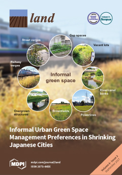
Informal Urban Green Space: Residents’ Perception, Use, and Management Preferences across Four Major Japanese Shrinking Cities

Peer-reviewed publication
Septembre, 2017
Japon

Urban residents’ health depends on green infrastructure to cope with climate change. Shrinking cities could utilize vacant land to provide more green space, but declining tax revenues preclude new park development—a situation pronounced in Japan, where some cities are projected to shrink by over ten percent, but lack green space. Could informal urban green spaces (IGS; vacant lots, street verges, brownfields etc.) supplement parks in shrinking cities?