Aller au contenu principal

page search

Displaying 25 - 36 of 277

A resistência da comunidade quilombola do Forte Príncipe da Beira

Reports & Research
Juillet, 2018
Brésil

A comunidade quilombola do Forte Príncipe da Beira fica no município de Costa Marques, Estado de Rondônia/Brasil. Abrange a extensão de 20.108,8709 hectares em plena região amazônica. Forma parte desses territórios chamados de “Negros do Guaporé” constituídos a partir de distintos processos de territorialização, desde o século XVIII na linha de fronteira entre Brasil e Bolívia...

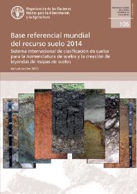
Base referencial mundial del recurso suelo 2014

Journal Articles & Books
Juin, 2018
France
United States of America
Luxembourg
Bulgaria
Chile
Australia
Denmark
Austria
Poland
Netherlands
Argentina
New Zealand
Canada
Brazil
Ghana

La tercera edición de la WRB incorpora, en el nuevo capítulo 2, elementos que permiten generar nombres taxonómicos mucho más informativos que llevan a deducir con facilidad la génesis y funciones de los suelos. Por otro lado, esta nueva versión de la WRB facilita la elaboración de leyendas de mapas a varias escalas para uso multifinalitario.

Base de référence mondiale pour les ressources en sols 2014, Mise à jour 2015. Système international de classification des sols pour nommer les sols et élaborer des légendes de cartes pédologiques

Journal Articles & Books
Juin, 2018
France
Belgium
United States of America
Philippines
Canada
Nicaragua
Bulgaria
Madagascar
Denmark
Luxembourg
Poland
Netherlands
Venezuela
New Zealand
Brazil
Ghana

La première édition de la Base de référence mondiale pour les ressources en sols (WRB) a été publiée lors du 16ème Congrès Mondial de la Science du Sol à Montpellier en 1998. Lors du même événement, elle fut adoptée comme système de corrélation des sols et de communication internationale de l'Union Internationale des Sciences du Sol (IUSS). La seconde édition de la WRB a été publiée au 18ème Congrès Mondial à Philadelphie en 2006.

Ministry of Development Policy Framework 2018 - 2023

Reports & Research
Avril, 2018
Brunei Darussalam

THE Ministry of Development (MoD)’s Policy Framework and Strategic Plan 2018-2023 is a comprehensive plan that outlines the policy direction in priority areas and provides strategy and implementation arrangements from aspects of land use planning, infrastructure development and environmental management so that they are closely coordinated with the country’s socio-economic development in line with duties and responsibilities towards the realisation of Brunei Vision 2035.

Putting Community and Rights on the Map in Southern Kenya

Reports & Research
Mars, 2018
Kenya

Throughout 2017, Spatial Collective applied new technologies to the data capture element of land registration in order to test whether affordable tools for documentation of land exist, whether these tools can reach the accuracy standards required by the state, and whether communities can replicate the work of a professional surveyorTo do this, our research looked into the land demarcation process, determined whether new technologies were of quality and met national standards, and gauged the most cost-effective tools which are widely accessible to local c

The Necessity for Open Data on land and property rights

Policy Papers & Briefs
Mars, 2018
Global

Data and information on land are fundamental for enabling smallholder farmers to gain secure access and control over their land, which provides the basis for investing in their operations.
This briefing paper outlines the importance and benefits of increasing the availability and accessibility of land information in support of improved food security and nutrition.

World Bank: The Sahel and West Africa Program (SAWAP), in support of the Great Green Wall Initiative

Reports & Research
Décembre, 2017
Africa

Sahelian Africa is significantly affected by rainfall variability. Its populations are among the poorest and most threatened by climatic changeability and land degradation, as they depend heavily on healthy ecosystems to sustain their livelihoods. Increasing pressures on food, fodder, and fuelwood have a significant impact on the environment; and frequent droughts and poorly managed land and water resources contribute to expanding soil erosion. The Great Green Wall for the Sahara and the Sahel Initiative emerged in 2007 to address climate change, land degradation, and desertification.

Identificación General de la Frontera Agrícola en Colombia

Policy Papers & Briefs
Décembre, 2017
Latin America and the Caribbean
Colombia

Este documento contiene la identificación general de la frontera agrícola en Colombia, a escala 1:100.000. En éste se presenta el marco de referencia, la definición de frontera agrícola y el proceso metodológico para su identificación. La definición e identificación de la frontera agrícola se constituye en un referente, a escala nacional para orientar la formulación de política pública y focalizar la gestión e inversiones del sector agropecuario y de desarrollo rural.

The experience of application of space images for creation of the land use map of irrigated lands and laylands of Svetloyarsk irrigation system

Journal Articles & Books
Décembre, 2017
Russia

The experience of space images use for creation of land use map for the terriotory of the Svetloyar irrigation system and neighboring households is considered. The investigation territory is located in the north-west area on the right bank part of Kaspian lowland (Volgograd region). The land use map reflects the actual conditions of the object and contains the information about the fields under different crops and mixed-age laylands.