land cover
AGROVOC URI: http://aims.fao.org/aos/agrovoc/c_37897
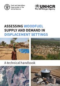
Assessing woodfuel supply and demand in displacement settings
This manual presents a methodology for assessing woodfuel supply and demand at the level of the displacement camp through the collection of primary data in the field and remote sensing analysis. The methodology uses a multi-sectoral approach to assess the energy-related needs and challenges of people in both displaced and host communities. The first part of the manual presents the methodology for assessing demand for woodfuel, which is structured around four sequential steps.
Reshaping the terrain: Forest landscape restoration in Uganda
The National Forestry Authority has monitored Ugandas land cover, including forested areas, periodically since 1990. The land cover classification is comprised of 13 classes as shown in the table below. The first five classes in the table refer to the different types of forests in Uganda. The largest forest type is woodland. Compared to other landcover types, forests are a small proportion of the country area.
Global Forest Resources Assessment 2015
The Global Forest Resources Assessment 2015 (FRA 2015) development began in June 2011 when the FRA Advisory Group discussed the FRA Long-Term Strategy and its implications for FRA 2015. The design process involved users, national correspondents and experts from a wide variety of technical backgrounds.
Land suitability analysis for agriculture in the Abbay basin using remote sensing, GIS and AHP techniques
To meet growing population demands for food and other agricultural commodities, agricultural land-use intensification and extensification seems to be increasing in the Abbay (Upper Blue Nile) basin in Ethiopia. However, the amount, location and degree of suitability of the basin for agriculture seem not well studied and/or documented. From global data sources, literature review and field investigation, a number of agricultural land suitability evaluation criteria were identified.
Contradictory hydrological impacts of afforestation in the humid tropics evidenced by long-term field monitoring and simulation modelling
The humid tropics are exposed to an unprecedented modernisation of agriculture involving rapid and mixed land-use changes with contrasted environmental impacts. Afforestation is often mentioned as an unambiguous solution for restoring ecosystem services and enhancing biodiversity. One consequence of afforestation is the alteration of streamflow variability which controls habitats, water resources, and flood risks. We demonstrate that afforestation by tree planting or by natural forest regeneration can induce opposite hydrological changes.
BMP implementations in Himalayan context: can a locally-calibrated SWAT assessment direct efforts?
Soil erosion due to accelerating runoff in various land cover types pose a serious threat to the long term sustainability of the fragile Himalayan landscape characterized by subsistence farming. Delimitation of high runoff zones, fostering soil erosion in the agricultural dominated watersheds is thus a necessity for watershed managers, NGO’s, urban planners, policy makers, and municipal administrations. The approach is practical, SWAT is a straightforward modeling system using GIS information. The BMP is also a very practical approach to mitigation of runoff accumulation on sub basin.
Regional assessment of groundwater recharge in the lower Mekong Basin
Groundwater recharge remains almost totally unknown across the Mekong River Basin, hindering the evaluation of groundwater potential for irrigation. A regional regression model was developed to map groundwater recharge across the Lower Mekong Basin where agricultural water demand is increasing, especially during the dry season. The model was calibrated with baseflow computed with the local-minimum flow separation method applied to streamflow recorded in 65 unregulated sub-catchments since 1951.
Journal of Soil WaterThe Use of Remote Sensing and Geographic Information System Techniques to Determine Relationships between Land Use and Landform
This paper reports on an exercise in obtaining landform information from a Digital Elevation Model (DEM) using Geographic Information Systems (GIS), and relating land cover information from satellite data to the landform classes and soil formation. The Beypazari area (northern Turkey) was chosen because of its varied landforms, land use and land cover. Soil samples, collected from forty-four soil pits were analysed and classified. Most of the soils were classified as Entisol and Inceptisol. In general, the effect of parent material on soil formation was dominated by landform.
Relationship between species composition of birds crossing over boundaries of patchy woodlands and surrounding landcover
Recent studies have indicated that conditions of surrounding landscape matrix around a habitat patch can influence avian community in the patch. This fact suggests the importance of the permeability of habitat boundaries for bird individuals. In this study species composition of birds in and around woodland patches and that of birds crossing over the woodland boundaries were surveyed in urban or suburban landscapes in central Japan. The results were as follows. 1) In suburban landscapes urban avoider species are not likely to cross woodland patch boundaries while urban adapter species are.
Changes in physical and chemical properties of integrated cover soils with different methods and rates of phosphogypsum application
The studies were conducted in the Rostov region I 2009-2014. The object of research is black southern chernozems (zonal soils) and alkali fine soils, which make up integrated soil cover with more than 35% alkali. According to the scheme of the experiment, the effect of phosphogypsum (PG) applied in doses 5 and 10 t/ha on alkali and zonal soils properties at the background of deep tillage by application of accepted (overall application) and proposed (selective application) practices on soil complex has been studied.


