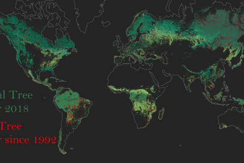
Every year on April 22nd over a billion people across the world come together to observe Earth Day. First established in 1970, Earth Day was created to drive action in combatting the ongoing global environmental and climate crisis. The theme of the 2021 event is Restore Our Earth. The 2021 Earth Day campaign covers various concepts for how we can restore our earth, but sometimes these can be difficult to visualise.
land cover mapping
Land cover mapping is a semantic segmentation problem: each pixel in an aerial or satellite image must be classified into one of several land cover classes. These classes describe the surface of the earth and are typically broad categories such as “forest” or “field”. High-resolution land cover data (≤1m / pixel) is essential in many sustainability-related applications. Its uses include informing agricultural best management practices, monitoring forest change over time and measuring urban sprawl. However, land cover maps quickly fall out of date and must be updated as construction, erosion, and other processes act on the landscape.
Source:
Large Scale High-Resolution Land Cover Mapping with Multi-Resolution Data
Caleb Robinson, Le Hou, Kolya Malkin, Rachel Soobitsky, Jacob Czawlytko, Bistra Dilkina, Nebojsa Jojic
The IEEE Conference on Computer Vision and Pattern Recognition (CVPR), 2019