page search

Displaying 1933 - 1944 of 6254

Décret n° 2009-1302 du 20 novembre 2009 portant creation et fixant les règles d’organisation et de fonctionnement de l’Agence Nationale de l’Aménagement du Territoire (ANAT).

Regulations
November, 2009
Senegal

Le présent décret crée l’Agence nationale de l’Aménagement du Territoire (ANAT), ayant pour missions de promouvoir et de mettre en œuvre la politique gouvernementale en matière d’aménagement du territoire, de travaux géographiques et cartographiques et d’amélioration du cadre de vie des populations.

Décret n° 2009-401 du 13 octobre 2009 relatif aux attributions du ministre à la présidence chargé des zones économiques spéciales.

Regulations
October, 2009
Congo

Le présent décret définit les attributions du ministre à la présidence chargé des zones économiques spéciales. Le ministre à la présidence chargé des zones économiques spéciales exécute la politique de la Nation telle que définie par le Président de la République dans les domaines des zones économiques spéciales.

Rapport sur la mise en œuvre du programme intégré pour le développement de l'agriculture en Afrique (CAADP)

Reports & Research
August, 2009
Africa

Après avoir été largement négligée pendant plus de deux décennies, l’agriculture figure désormais au premier rang des priorités de développement en Afrique. Étant donné l’importance cruciale de ce secteur dans la plupart des pays du continent, les chefs d’État et de gouvernement de l’Union africaine ont choisi, en juillet 2001, de l’incorporer en tant que seul productif parmi les cinq priorités sectorielles du Nouveau Partenariat pour le développement de l’Afrique. Ce choix a été plus tard renforcé par l’initiative du Secrétaire général de l’ONU en faveur de la révolution verte africaine.

Using a touch table to support participatory land use planning

Conference Papers & Reports
July, 2009

Designing land use plans for areas with multiple stakeholders is becoming an increasingly complex task. This paper presents a method to interactively develop land use plans with multiple stakeholders and conflicting objectives. In this method, spatial information plays a central role. Maps are used to communicate and exchange knowledge among policy-makers and stakeholders. This is done through a series of interconnected workshops, where interaction between stakeholders is prompted through the use of maps, decision support tools and an instrument called the 'touch table'.

Land Sector Framework 2009-2018 - "A prosperous, equitable & sustainable Land sector for Vanuatu".

National Policies
June, 2009
Vanuatu

This Land Sector Framework (LSF) provides the foundation for a strategic plan to implement land sector reforms in Vanuatu. It is intended to guide government, the private sector and civil society in the use and management of Vanuatu’s land resources. The LSF is based on a Vision and a set of strategic objectives. It outlines implementation priorities for a LSF policy and activity agenda over a ten year period and builds upon the 2006 National Land Summit (NLS) resolutions and recent donor initiatives in the sector.

Regulation on supervision over the elaboration of the forestry fundamentals.

Regulations
June, 2009
Bosnia and Herzegovina

This Regulation hereby prescribes the mandatory supervision rules, aimed at the control over the execution of the preparation of forest-economic documents or plans (for private and state owned forests).Forest-economic planning documents are projects assignment for the preparation of the forest-economic basis, including the classification of forests and forest land in ecological-productive terms, with the aim of determining the technical objectives of forest management (such as creation of spatial units, the marking of their boundaries in the field, the recording of boundaries and their mapp

Regulation on drafting of the forestry connection projects.

Regulations
June, 2009
Bosnia and Herzegovina

This Regulation prescribe the necessary contents of the documentation and administrative forms that are to be included when drafting/preparing the forest or forest land communication projects (such as the construction of forest road for vehicles, reconstruction of forest truck routes and tractor/trailway paths).As defined by this text, forest communications/connections are primary used for forestry purposes as well as for the needs of the local population.

Implements: Forest Law (Republic of Srpska). (2008-07-17)

Decree No. 135/PM on State Land Lease or Concession.

Regulations
May, 2009
Laos

This Decree, consisting of 53 articles divided into eight Parts, regulates State Land Lease or Concession. It determines the principles, procedures, and measures regarding granting of state land for lease or concession with the aim to ensure the uniform management and use throughout the country, to boost the development of state land, to turn land into capital, to promote the investment for cash crop production and for services, and to build income for the state budget.

The Chinese Road to Mandalay

Reports & Research
March, 2009
Myanmar

Burma's second city looks back on 150 years of rich history...

"HISTORY has greatly altered the face of Mandalay - and in this anniversary year, 150 years after its founding, Burma's second city is again undergoing radical change.

Ruled for many early years by Britain, Mandalay is now falling under the influence of a new wave of outsiders - "the Chinese.

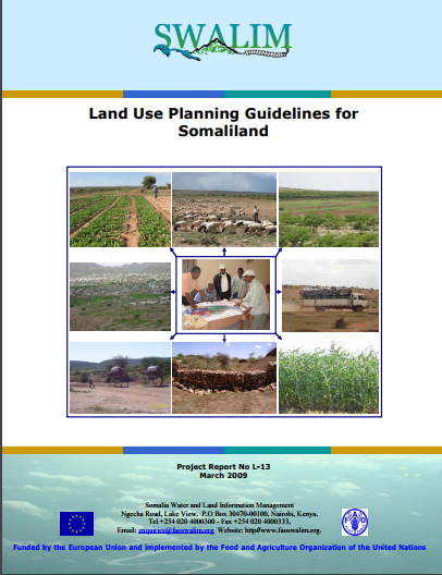
Land Use Planning Guidelines for Somaliland

Manuals & Guidelines
February, 2009
Africa

Purpose of the guidelines The purpose of the present Guidelines is threefold: 1. to explain the basic principles of land use planning 2. indicate which land use planning activities could be carried out in Somaliland at different levels, and how 3. provide a number of tools and resources which could be of practical use by land use planners in Somaliland The guidelines are not a manual which has to be followed strictly. Such manuals could be developed at a later stage, particularly for land use planning at village level.