page search

Displaying 133 - 144 of 277

State of the Art Report on Global and Regional Soil Information: Where are we? Where to go?

Journal Articles & Books
November, 2013
Angola
Greece
United States of America
Rwanda
China
Namibia
Australia
Eswatini
Canada
Iran
Iceland
Thailand
New Zealand
Kenya
Mozambique
Jordan
South Africa
Vietnam
Italy
Tanzania
Botswana
Kazakhstan
Mongolia

Under the current challenges of food security, climate change adaptation and mitigation, further provision of ecosystem services and sustainable intensification of agriculture, soil information becomes fundamental to guide wise policies and decisions. This document reviews the present availability of soil information from legacy maps and reports and from ongoing Digital Soil Mapping efforts. Currently, the soil science community is limited in its capacity to provide accurate and updated information to the different soil users.


Integrating Communities into REDD+ in Indonesia

November, 2013

The Government of Indonesia (GOI) is in
the process of designing a national REDD+ mechanism to allow
it to access donor funding in the medium term, and funding
from a potential performance based mechanism in the long
term. This policy brief is focused on the broad question of
how REDD+ can address underlying community issues such as
lack of access to forest land, and does not deal with the
more specific questions of legal and institutional

Linking Land Cover Data and Crop Yields for Mapping and Assessment of Pollination Services in Europe

Peer-reviewed publication
September, 2013

Pollination is a key ecosystem service as many crops but in particular, fruits and vegetables are partially dependent on pollinating insects to produce food for human consumption. Here we assessed how pollination services are delivered at the European scale. We used this assessment to estimate the relative contribution of wild pollinators to crop production. We developed an index of relative pollination potential, which is defined as the relative potential or relative capacity of ecosystems to support crop pollination.

AN EVALUATION OF THE CADASTRAL SYSTEM IN KENYA AND A STRATEGY FOR ITS MODERNIZATION

Reports & Research
July, 2013
Kenya

The Cadastral system in Kenya was established in 1903 to support land alienation for the white settlers who had come into the country in the early part of the 20th Century. In the last hundred years, the system has remained more or less the same, where land records are kept in paper format and majority of operations are carried out on a manual basis. The lack of a modern cadastral system has contributed to problems in land administration in the country.

Participatory Methodology for Planning of Peri Urban Land Use in Situ

Journal Articles & Books
June, 2013
Tanzania

The future is increasingly urban and inevitably so. Urbanisation is increasing at unprecedented rate in both Sub-Saharan Africa and developing world (UN Habitat, 1999). Alongside this rapid expansion comes the emergence of the peri-urban areas that are characterised of increasing intensification and co-existence of urban and rural areas, marked by dynamic flows of commodities, capital, natural resources, people and environmental pollution.

120 Years of Surveys and Mapping in Tanzania (1893 – 2013)

Journal Articles & Books
June, 2013
Tanzania

The history of surveys and mapping in Tanzania has been influenced by two European cultures through its colonization; first by the German and then by the British. During the German Administration, surveys and mapping activities were carried out by the Department of Surveys and Agriculture from 1893 to 1914. When the British took over the mandate for the territory after World War I, the also used the “old” German maps until when they when they started the surveys to produce other topographic maps from 1946. In 1961, the Surveys and Mapping Division was created.

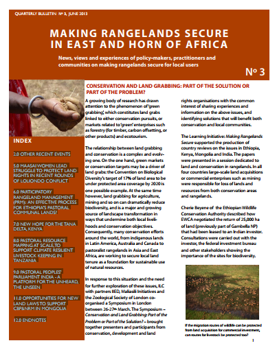
CONSERVATION AND LAND GRABBING: PART OF THE SOLUTION OR PART OF THE PROBLEM?

Policy Papers & Briefs
May, 2013
Africa

2.0 OTHER RECENT EVENTS 5.0 MAASAI WOMEN LEAD STRUGGLE TO PROTECT LAND RIGHTS IN RECENT ROUNDS OF LOLIONDO CONFLICT 6.0 PARTICIPATORY RANGELAND MANAGEMENT (PRM): AN EFFECTIVE PROCESS FOR ETHIOPIA’S PASTORAL COMMUNAL LANDS? 7.0 NEW HOPE FOR THE TANA DELTA, KENYA 8.0 PASTORAL RESOURCE MAPPING AT SCALE,TO SUPPORT CLIMATE RESILIENT LIVESTOCK KEEPING IN TANZANIA 9.0 PASTORAL PEOPLES’ PARLIAMENT INDIA - A PLATFORM FOR THE UNHEARD, THE UNSEEN 11.0 OPPORTUNITIES FOR NEW LAND LAWS TO SUPPORT CBP&NRM IN MONGOLIA 12.0 ENDNOTES

Mapping Urbanization Dynamics in Major Cities of Colombia, Ecuador, Perú, and Bolivia Using Night-Time Satellite Imagery

Peer-reviewed publication
March, 2013
Ecuador
Bolivia
Colombia
Peru

By 2050, 90% of the population in Latin America will live in cities, but there is a lack of up-to-date spatial information about the urban extent and patterns of urbanization in cities of this region. In this study, we analyzed population growth, urban density and urbanization dynamics between 1992 and 2009 in the major cities of Bolivia, Colombia, Ecuador and Perú using Google Earth and DMSP/OLS night-time lights imagery. We used Google Earth to map the urban extent, and time series of night-time lights to analyze spatial patterns of urban development.

The County Governments Act, 2012

Legislation & Policies
October, 2012
Kenya

COUNTY GOVERNMENTS ACT NO. 17 OF 2012

Date of assent: 24th July, 2012.

Date of commencement: See Section 1.

An Act of Parliament to give effect to Chapter Eleven of the Constitution; to provide for county governments' powers, functions and responsibilities to deliver services and for connected purpose

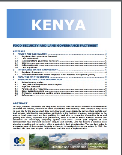
Food security and land governance factsheet

Journal Articles & Books
Reports & Research
June, 2012
Kenya

In Kenya, insecure land tenure and inequitable access to land and natural resources have contributed to conflict and violence, which has in return exacerbated food insecurity. Most farmers in Kenya have no legal title for the land on which they farm. Sources of tenure insecurity can be ethnic conflicts over land between neighbouring communities, particularly in the Northern provinces, expropriation by the state or local government and land grabbing by local elite or companies. Competition is as well growing over water, especially over groundwater, which is scarce in Kenya.