page search

Displaying 1201 - 1212 of 3144

Influence of Environmental Variables on Baylisascaris procyonis Infection in Raccoons

Journal Articles & Books
December, 2012

Baylisascaris procyonis is a zoonotic nematode commonly found in raccoons (Procyon lotor). Human-altered landscapes can support dense populations of raccoons, increasing the potential for interaction between humans and these animals. We used raccoon feces provided by licensed fur trappers to investigate environmental variables that influence prevalence of B. procyonis at 2 sites in Wisconsin. Trappers submitted raccoon feces to us, along with information on sex, age (juvenile and adult), and approximate trap location for each animal.

Improving classification accuracy of airborne LiDAR intensity data by geometric calibration and radiometric correction

Journal Articles & Books
December, 2012

Airborne light detection and ranging (LiDAR) systems are used to measure the range (distance from the sensor to the target) and the intensity data (the backscattered energy from the target). LiDAR has been used extensively to model the topography of the Earth surface. Nowadays, LiDAR systems operating in the near-infrared spectral range are also gaining high interest for land cover classification and object recognition. LiDAR system requires geometric calibration (GC) and radiometric correction (RC) in order to maximize the benefit from the collected LiDAR data.

Analyzing wildfire exposure and source–sink relationships on a fire prone forest landscape

Journal Articles & Books
December, 2012
United States of America

We used simulation modeling to analyze wildfire exposure to social and ecological values on a 0.6millionha national forest in central Oregon, USA. We simulated 50,000 wildfires that replicated recent fire events in the area and generated detailed maps of burn probability (BP) and fire intensity distributions. We also recorded the ignition locations and size of each simulated fire and used these outputs to construct a fire source–sink ratio as the ratio of fire size to burn probability.

Land Cover/Land use Mapping Using Different Wavelet Packet Transforms for LISS IV Madurai Imagery

Journal Articles & Books
December, 2012

Texture in high resolution satellite images requires substantial improvement in the conventional segmentation algorithms. The use of wavelet packet transforms for texture analysis and image classification of high spatial resolution LISS IV imagery provide more details about the urban areas. This paper analyses the performance of a combination of Wavelet Packet Statistical Features (WPSFs) and Wavelet Packet Co-occurrence Features (WPCFs) for the classification of LISS IV images. The classification accuracy per pixel is improved in this paper by varying the window size.

Pollution attenuation by roadside greenbelt in and around urban areas

Journal Articles & Books
December, 2012
Bangladesh

Greenbelts are effective tools for mitigation of traffic induced air and noise pollution. In this study, the potential role of greenbelts along the roadside for the reduction of air pollution and noise levels has been assessed by using seasonally monitored data in a megacity of Bangladesh. Correlation analysis was performed between the vegetation status, measured by canopy density and shelterbelt porosity, and the total suspended particles (TSP) removal percentage. Further, the reduction of noise level was also analyzed.

Has urbanization changed ecological streamflow characteristics in Maine (USA)?

Journal Articles & Books
December, 2012
United States of America

This paper examines the potential effects of urbanization on streamflow in Maine, USA, from 1950 to 2000. The study contrasts nine watersheds in southern Maine, which has seen steady urban growth over the study period, with nine rural watersheds from northern Maine. Historical population data and current land cover data are used to develop an urbanization score for each watershed. Trends in watershed urbanization over the study period are compared to trends in ecologically relevant streamflow characteristics.

Habitats of Suburban Barred Owls (Strix varia) and Red-Shouldered Hawks (Buteo lineatus) in Southwestern Ohio1

Journal Articles & Books
December, 2012

Little is known about the habitat and ecology of suburban Barred Owls (Strix varia), a species sometimes considered the nocturnal equivalent of Red-shouldered Hawks (Buteo lineatus). We compared nesting habitat of Barred Owls to that of Red-shouldered Hawks nesting in suburban and urban areas, in and near the city of Cincinnati, Ohio, to determine whether any features distinguished owl nest sites from hawk nest sites.

Land-cover classification of an intra-urban environment using high-resolution images and object-based image analysis

Journal Articles & Books
December, 2012
Brazil

Detailed, up-to-date information on intra-urban land cover is important for urban planning and management. Differentiation between permeable and impermeable land, for instance, provides data for surface run-off estimates and flood prevention, whereas identification of vegetated areas enables studies of urban micro-climates. In place of maps, high-resolution images, such as those from the satellites IKONOS II, Quickbird, Orbview and WorldView II, can be used after processing.

Agribusiness Indicators

Reports & Research
Training Resources & Tools
December, 2012
Zambia
Africa

Agriculture and agribusiness play an important role in the Zambian economy, contributing around 20 percent of gross domestic product (GDP) in recent years and about 12 percent of national export earnings. Agriculture employs nearly 70 percent of the labor force and remains the main source of income and employment for most of the people living in rural areas. The objective of the Zambia agribusiness indicators (ABI) country report is to examine factors that have affected agricultural productivity, market access, and the policy environment for agriculture in Zambia.

Transformation through Infrastructure

Reports & Research
Policy Papers & Briefs
December, 2012

Infrastructure can be an agent of change in addressing the most systemic development challenges of today s world from social stability to rapid urbanization, climate change adaptation and mitigation, natural disasters, and global issues such as food and energy security. Transformation through Infrastructure the updated World Bank Group Infrastructure Strategy FY12-15 - lays out the framework for transforming the Bank Group s engagement in infrastructure.

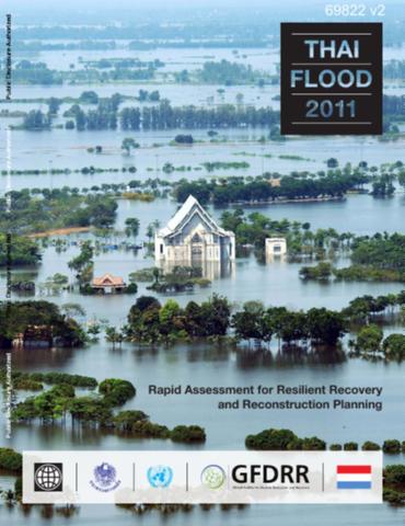
Thai Flood 2011

Reports & Research
Training Resources & Tools
December, 2012
Thailand
Eastern Asia
Oceania

This report outlines these findings, including damage and loss estimates and social and economic impacts, and proposes strategies for resilient recovery and reconstruction planning. Heavy rain combined with multiple tropical storms throughout the extended rainy season played a large part in the extensive flooding. Flash floods were reported in several areas in the north in May, and tropical depression Haima arrived in June followed by Nock-Ten in July, the combination of which caused widespread flooding.

A Toolkit of Policy Options to Support Inclusive Green Growth

Reports & Research
Policy Papers & Briefs
December, 2012

In 2012, the Mexican Presidency of the G20 introduced inclusive green growth as a cross-cutting priority on the G20 development agenda. The second meeting of the G20 Development Working Group (DWG), hosted by the Government of the Republic of Korea, took place in Seoul the 19th and 20th of March 2012. As agreed during the first DWG meeting, this second meeting focused on the priorities for their presidency in the first half of 2012: infrastructure, food security and inclusive green growth (IGG).