page search

Displaying 325 - 336 of 8599

Urban proximity, demand for land and land shadow prices in Malawi

Peer-reviewed publication
April, 2020
Malawi

We assess the spatial and intertemporal variation in farmland prices using per hectare minimum willingness to accept (WTA) sales and rental (shadow) prices in Malawi. We use three rounds of nationally representative farm household panel data from the Living Standards Measurement Surveys (LSMS), collected in 2010, 2013 and 2016. The sample is split in quintiles based on distance from the nearest major city, building on the land valuation and transaction cost theory, and agrarian political economy perspectives on global and national land transactions.

Impact of national policies on patterns of built-up development: an assessment over three decades

Peer-reviewed publication
April, 2020
Romania

Globally, built-up development is taking place at unprecedented rates. To mitigate and limit its effects, recent scientific and spatial planning communities call for built-up management to be addressed on broader scales, from regional to national, and coordinated with multiple policy domains. In this paper, we aimed to analyze the evolution and impact of Romania’s national policies on built-up management during the entire period from the fall of the communist regime to the present.

An assessment of the implications of alternative scales of communal land tenure formalization in pastoral systems

Peer-reviewed publication
April, 2020
Ethiopia

Pastoralism faces diverse challenges, that include, among others, land tenure insecurity, that has necessitated the need to formalize land rights. Some governments have started regularizing rights for privately owned land, but this is complex to implement in pastoral areas where resources are used and managed collectively. Our aim was to assess how the scale of communal land tenure recognition in pastoralist systems may affect tradeoffs among objectives such as tenure security, flexibility, mobility, and reduction of conflicts.

Rethinking “development”: Land dispossession for the Rampal power plant in Bangladesh

Peer-reviewed publication
April, 2020
Bangladesh

In this article, we critically review the developmental claims made for the construction of the Rampal power plant in southwestern Bangladesh, in the light of evidence about transformations of land control related to this construction project. Land has become a heavily contested resource in the salinity-intruded southwestern coastal area of Bangladesh. Changes in land control for the construction of the Rampal power plant and similar projects have intensified decades of struggles over rights and access to land.

Cartographie des changements de l’occupation du sol entre 2002 et 2016 à partir des images Landsat. Cas de la région Tanger Tetouan Al-Hoceima (Maroc).

Peer-reviewed publication
April, 2020
Morocco

La région Tanger-Tetouan-Al Hoceima située au nord-ouest du Maroc a connu, dans des dernières décennies, différents travaux d’aménagement de territoire qui ont eu, certainement, un impact sur le paysage et l’écosystème de la région. La région a accueilli des infrastructures de grandes tailles telles que le port Tanger Med installé au bord du détroit Gibraltar, la ligne de train à grande vitesse reliant Tanger à Casablanca, réseaux routiers, barrages…etc. L’objectif de cet article est de cartographier les changements du paysage de la région via l’analyse diachronique de l’occupation du sol.

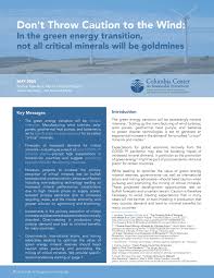
Don't Throw Caution to the Wind: In the green energy transition, not all critical minerals will be goldmines

Manuals & Guidelines
April, 2020
Global

This note proves recommendations for governments, international actors, and mining advocates who seek to optimize the value of green energy mineral reserves, to ensure that expectations for green energy materials do not replace careful planning, impact assessment, and allocation of risks, as well as prevent over-production.

Drivers and Implications of Land Use/Land Cover Dynamics in Finchaa Catchment, Northwestern Ethiopia

Peer-reviewed publication
April, 2020
Global

Understanding the trajectories and extents of land use/land cover change (LULCC) is important to generate and provide helpful information to policymakers and development practitioners about the magnitude and trends of LULCC. This study presents the contributing factors of LULCC, the extent and implications of these changes for sustainable land use in the Finchaa catchment. Data from Landsat images 1987, 2002, and 2017 were used to develop the land use maps and quantify the changes. A supervised classification with the maximum likelihood classifier was used to classify the images.

Effect of Land Use and Land Cover Change on Soil Erosion in Erer Sub-Basin, Northeast Wabi Shebelle Basin, Ethiopia

Peer-reviewed publication
April, 2020
Ethiopia

Land use and land cover change (LULCC) is a critical factor for enhancing the soil erosion risk and land degradation process in the Wabi Shebelle Basin. Up-to-date spatial and statistical data on basin-wide erosion rates can provide an important basis for planning and conservation of soil and water ecosystems. The objectives of this study were to examine the magnitude of LULCC and consequent changes in the spatial extent of soil erosion risk, and identify priority areas for Soil and Water Conservation (SWC) in the Erer Sub-Basin, Wabi Shebelle Basin, Ethiopia.

Environmental Transformations in the Area of the Kuźnica Warężyńska Sand Mine, Southern Poland

Peer-reviewed publication
April, 2020
Poland

On the basis of the analysis and interpretation of maps, published literature, and environmental reconnaissance, this article discusses environmental transformations in the area of the Kuźnica Warężyńska sand mine in southern Poland over the years 1944–2015. A comprehensive ecological analysis was carried out concerning spatial development, mining activity, hydrogeological and hydrological conditions as well as the biotic environment.

Trade-Offs between Economic Benefits and Ecosystem Services Value under Three Cropland Protection Scenarios for Wuhan City in China

Peer-reviewed publication
April, 2020
China

Over the past few decades urbanization and population growth have been the main trend all over the world, which brings the increase of economic benefits (EB) and the decrease of cropland. Cropland protection policies play an important role in the urbanization progress. In this study, we assess the trade-offs between EB and ecosystem services value (ESV) under three cropland protection policy scenarios using the LAND System Cellular Automata for Potential Effects (LANDSCAPE) model.

Spatial-Temporal Characteristics of Cultivated Land Use Efficiency in Major Function-Oriented Zones: A Case Study of Zhejiang Province, China

Peer-reviewed publication
April, 2020
China

Promoting cultivated land use efficiency (CLUE) coordinated development in various major function-oriented zones is a measure to deal with unbalanced development of territorial space in China.

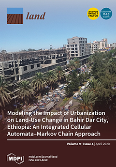
Modeling the Impact of Urbanization on Land-Use Change in Bahir Dar City, Ethiopia: An Integrated Cellular Automata–Markov Chain Approach

Peer-reviewed publication
April, 2020
Ethiopia

The fast-paced urbanization of recent decades entails that many regions are facing seemingly uncontrolled land-use changes (LUCs) that go hand in hand with a range of environmental and socio-economic challenges. In this paper, we use an integrated cellular automata–Markov chain (CA–MC) model to analyze and predict the urban expansion of and its impact on LUC in the city of Bahir Dar, Ethiopia. To this end, the research marshals high-resolution Landsat images of 1991, 2002, 2011, and 2018.