Location
The World Agroforestry Centre (ICRAF) is a CGIAR Consortium Research Centre. ICRAF’s headquarters are in Nairobi, Kenya, with six regional offices located in Cameroon, China, India, Indonesia, Kenya and Peru.
The Centre’s vision is a rural transformation throughout the tropics as smallholder households increase their use of trees in agricultural landscapes to improve their food security, nutrition security, income, health, shelter, social cohesion, energy resources and environmental sustainability.
ICRAF's mission is to generate science-based knowledge about the diverse benefits - both direct and indirect - of agroforestry, or trees in farming systems and landscapes, and to disseminate this knowledge to develop policy options and promote policies and practices that improve livelihoods and benefit the environment.
The World Agroforestry Centre is guided by the broad development challenges pursued by the CGIAR. These include poverty alleviation that entails enhanced food security and health, improved productivity with lower environmental and social costs, and resilience in the face of climate change and other external shocks.
ICRAF's work also addresses many of the issues being tackled by the Sustainable Development Goals (SDGs) that aim to eradicate hunger, reduce poverty, provide affordable and clean energy, protect life on land and combat climate change.
Members:
Resources
Displaying 106 - 110 of 146Evidence-based scaling-up of evergreen agriculture for increasing crop productivity, fodder supply and resilience of the maize-mixed and agro-pastoral farming systems in Tanzania and Malawi
Evidence-based Scaling-up of Evergreen Agriculture for Increasing Crop Productivity, Fodder Supply and Resilience of the maize-mixed and agropastoral farming systems in Tanzania and Malawi Interim technical report July 2012
Local knowledge training using the AKT5 software and methodology at Mekelle University, funded by the AfricaRISING project: A report on a two week research study in the village of Abreha We Atsbeha in Tigray Region, northern Ethiopia
Agroforestry and Forestry in Sulawesi series: profitability and land use systems in South and Southeast Sulawesi
This profitability assessment is an early effort to generate baseline information for the Agroforestry and Forestry in Sulawesi: Linking Knowledge with Action project the ‘AgFor project’ , for implementation in two provinces, South Sulawesi and Southeast Sulawesi. The study collected information on existing farming systems and estimated profitability for each land use. The profitability indicators used in the study are: net present value NPV , equivalent annuity and return to labour.
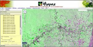
Mapaz: population and environment web mapping for the sustainable Amazon
Mapaz helps policymakers and scientists target research and development or conservation activities in the Amazon by pulling together information on elements such as deforestation, biomass, species diversity, population, poverty and regional land use. Users can define their own geographic areas or select existing administrative boundaries to get spatial information for that area in the form of maps and tables. For example, MAPAZ calculates biomass,

