Senegal has the particularity of being the westernmost point of the African continent, which is located at the tip of Almadies in Dakar, the country's capital. With an area of 196,722 km2 , Senegal is bordered by the Atlantic Ocean to the west, Mauritania to the north and Guinea and Guinea-Bissau to the south. The Gambia, a country located on either side of the river bearing the same name, forms an enclave within Senegal. The relief of Senegal is generally flat and low, with an average altitude of less than 50 metres over three quarters of the territory.
After Côte d'Ivoire, Senegal is the second largest economy in terms of gross domestic product (GDP) within the West African Economic and Monetary Union (WAEMU). Since the 1960s, the contribution of the agricultural, forestry and fisheries sectors to Senegal's GDP has been on a downward trend, but there has been an upturn since 2007. This rate will reach 17% in 2020.
Agricultural production, defined in the broadest sense (agriculture, arboriculture, fishing and livestock), represented the main income-generating activity for 49.5% of households in Senegal in 2013. The agricultural sector remains dominated by small family farms (less than 5 hectares for three quarters of households), which mostly practice rain-fed agriculture and, to a lesser extent, flood recession and irrigated crops. Livestock occupies 28.2% of Senegalese households and provides 55-75% of income in rural areas. In 2017, the national livestock population numbered 17,865,881 head, mostly composed of sheep (39%), goats (33%) and cattle (20%).
In both urban and rural areas, land in this small country is highly coveted by domestic and foreign actors with diverse and even incompatible objectives. In addition to the demand for family and industrial agriculture, pastoralism, mining, infrastructure, tourism and housing, the pressure on land is amplified by population growth and soil degradation.
These land tenure issues differ according to the six eco-geographical zones in Senegal.
- The groundnut basin: This is an area where groundnut cultivation has been dominant since colonial times. This cultivation has led to massive deforestation and soil exhaustion, although the trend has been reversed since the 1980s with a reduction in cultivated areas and the regrowth of vegetation in the old fields. The groundnut basin also has a tradition of mining (phosphates, sand, clays and peat) in several open pits.
- The Senegal River Valley: located in the north of the country, this valley with an arid climate is crossed by the second largest river in West Africa, the Senegal River, which is 1,750 kilometres long. For a long time an area of recession agriculture on the alluvial plains,irrigated crops have been developing since the commissioning of the Diama and Manantali dams which control the flow of water. Animal husbandry is practised on the sandy uplands.
- The Niayes: these fertile lowlands along the maritime coast between Dakar and Saint-Louis are favourable to market gardening. However, droughts have led to a drop in the water table and salinization of the soil. Urbanisation, road infrastructure development and mining also threaten peri-urban agriculture.
- The sylvo-pastoral zone of the Ferlo: the main activity in this zone is extensive livestock farming. It is characterised by low rainfall, to which are added overgrazing and bush fires as factors degrading the woody potential.
- The sylvo-pastoral zone of the centre and south-east: often called Eastern Senegal, agriculture and livestock breeding are practised here, as well as the exploitation of the forest for the production of charcoal. The region of Kédougou is also rich in mining resources, especially gold.
- Casamance: This forested area with a tropical climate has seen an increase in temperature and rainfall in recent years. Rice cultivation in the lowlands is widespread, but is increasingly subject to salinity and acidity of the soil. Logging and bush fires are also reducing the forest cover .
- To read the full country profile and find other related information, please click here.
- To know more about the Country Insights initiative and see the full list of country portfolios, click here.
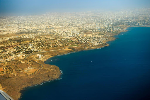
Photo: Aerial view of Dakar, photography by Gabriel de Castelaze (CC BY-NC-ND 2.0)