mining
AGROVOC URI: http://aims.fao.org/aos/agrovoc/c_49983
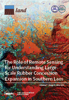
The context of REDD+ in the Lao People's Democratic Republic: Drivers, agents and institutions
Formalization as Development in Land and Natural Resource Policy
Shifting Formalization Policies and Recentralizing Power: The Case of Zimbabwe's Artisanal Gold Mining Sector
Determining the Frequency of Dry Lake Bed Formation in Semi-Arid Mongolia From Satellite Data
In the Mongolian Plateau, the desert steppe, mountains, and dry lake bed surfaces may affect the process of dust storm emissions. Among these three surface types, dry lake beds are considered to contribute a substantial amount of global dust emissions and to be responsible for “hot spots” of dust outbreaks. The land cover types in the study area were broadly divided into three types, namely desert steppe, mountains, and dry lake beds, by a classification based on Normalized Difference Water Index (NDWI) calculated from MODIS Terra satellite images, and Digital Elevation Model (DEM).
Dirty Water, Muddied Politics: Hybridisation of Local and National Opposition to Kumtor Mine, Kyrgyzstan
From a Mongolian ‘super mine’ to China’s One Belt One Road, rapid infrastructural development is reforging Central Asia as an economic pivot of the future. Such development offers enticing economic benefits, but threatens fragile environments and local livelihoods. Due to the weakness of the state, the emphasis will be on citizens to hold developers accountable to their social and environmental pledges. Reports of political elites influencing the demands of popular protests call into question the ability of citizens to fulfil this function.
Timacum Minus in Moesia Superior—Centrality and Urbanism at a Roman Mining Settlement
When applying traditional criteria of Roman urbanism, several settlements in the province of Moesia are not recognised as parts of the urban network. To avoid this, previous criteria of urbanism should be revised. This paper suggests revisions, which provide a more inclusive definition of urbanism: Thus, instead of focusing on administrative status and monumentality as primary markers of urbanity and urbanization, development factors for agglomeration and centrality are emphasized as decisive conditions for, and characteristics of, urban settlement.
People and Post-Mining Environments: PPGIS Mapping of Landscape Values, Knowledge Needs, and Future Perspectives in Northern Finland
Mining can have a notable environmental and social footprint both during the production phase and after the mine closure. We examined local stakeholders’ viewpoints on two post-mining areas in northern Finland, Hannukainen and Rautuvaara, using a public participation geographic information system (PPGIS) approach. Spatially explicit data on local residents’ and visitors’ values, knowledge needs, and future perspectives on mining landscapes were collected with an online map-based survey tool (Harava). The results show that post-mining sites were generally considered unpleasant places.
Determining Land Management Zones Using Pedo-Geomorphological Factors in Potential Degraded Regions to Achieve Land Degradation Neutrality
The proper delineation of site-specific management zones is very important in the agricultural land management of potentially degraded areas. There is a necessity for the development of prospective tools in management plans to correctly understand the land degradation processes. In order to accomplish this, we present a pedo-geomorphological approach using soil texture, land elevation and flow vector aspects to distinguish different management zones and to discretize soil micronutrients. To achieve this goal, we conducted the study in the Neyshabur plain, Northeast Iran.
An Assessment of Multiple Drivers Determining Woody Species Composition and Structure: A Case Study from the Kalahari, Botswana
Savannas are extremely important socio-economic landscapes, with pastoralist societies relying on these ecosystems to sustain their livelihoods and economy. Globally, there is an increase of woody vegetation in these ecosystems, degrading the potential of these multi-functional landscapes to sustain societies and wildlife. Several mechanisms have been invoked to explain the processes responsible for woody vegetation composition; however, these are often investigated separately at scales not best suited to land-managers, thereby impeding the evaluation of their relative importance.
Applying Text Mining for Identifying Future Signals of Land Administration
Companies and governmental agencies are increasingly seeking ways to explore emerging trends and issues that have the potential to shape up their future operational environments. This paper exploits text mining techniques for investigating future signals of the land administration sector. After a careful review of previous literature on the detection of future signals through text mining, we propose the use of topic models to enhance the interpretation of future signals.


