
page search

There are 454 content items of different types and languages related to land use mapping on the Land Portal.
Displaying 13 - 24 of 24

Copernicus Land User Event

17 November 2022 - 18 November 2022
Bedford Hotel & Congress Centre
Rue du Midi 135,1000 Bruxelles
Belgium

Copernicus Land User Event - Register now!

European and global land surface applications

Copernicus Land Monitoring Service

Uncovering Land Data Opportunities in Senegal

30 January 2023

The momentum is increasing around international land monitoring initiatives, together with an unprecedented demand for free, accessible, and usable land data and information. The land sector must find ways to seize opportunities presented by open data innovations while negotiating a rapidly changing data environment. 

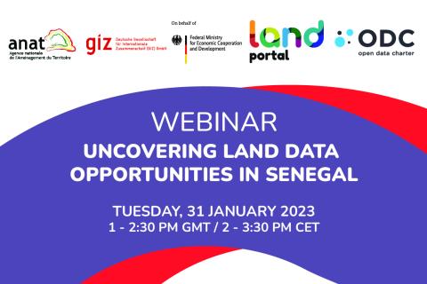
The Land Portal and Open Data Charter have been working with the Government of Senegal to open up land data, following the guidance set forth in the Open Up Guide for Land Governance. The Open Up Guide is a practical guide for governments who are seeking to better collect, publish, and use land data for the public good. As Phase 1 of this project, the team has published the State of Land Information in Senegal (SOLI) Report. SOLI reports are research-driven analyses of the current state of land data that assess the available land information against open data standards. 


The webinar will:

  • Share latest results from the Open Up Guide implementation pilot in Senegal and findings from the SOLI Senegal report 

  • Ask and discuss questions concerning the interest in and maturity of open data in Senegal as it relates to land 

  • Hear perspectives from the government of Senegal (ANAT, PROCASEF), donors (GIZ, World Bank), local community members, using specific case studies on data and land initiatives


Land Portal Foundation
Deutsche Gesellschaft für Internationale Zusammenarbeit (GIZ) GmbH
Government of Senegal

Fundamentals of Machine Learning for Earth Science

19 April 2023 - 03 May 2023

NASA’s Applied Remote Sensing Training Program (ARSET) has opened a new online introductory webinar series: Fundamentals of Machine Learning for Earth Science. This three-part training, presented in English and Spanish, is open to the public and will provide attendees an overview of machine learning in regards to Earth Science, and how to apply these algorithms and techniques to remote sensing data in a meaningful way. Attendees will also be provided with end-to-end case study examples for generating a simple random forest model for land cover classification from optical remote sensing. We will also present additional case studies to apply the presented workflows using additional NASA data.


Application of NASA SPoRT-Land Information System (SPoRT-LIS) Soil Moisture Data for Drought

16 May 2023 - 30 May 2023

NASA’s Applied Remote Sensing Training Program (ARSET) has opened a new open, online webinar series: Application of NASA SPoRT-Land Information System (SPoRT-LIS) Soil Moisture Data for Drought. This 3-part webinar series is focused on the introduction of the NASA Land Information System (LIS) output of soil moisture at various depths for drought analysis and monitoring. Examples from operational applications as well as practice exercises (for using LIS data for drought monitoring) will be included in this course. Access to the SPoRT-LIS products via online viewer, in GIS formats, and GIS-based display tools, will also be included. Moreover, self-paced microlessons will be available to help users confirm their understanding and improve their skill via homework lessons between live sessions.

Assessing the Impacts of Fires on Watershed Health

05 July 2023 - 12 July 2023

NASA’s Applied Remote Sensing Training Program (ARSET) has opened a new open, online webinar series: Assessing the Impacts of Fires on Watershed Health. This advanced-level, three-part training will focus on using remote sensing observations for monitoring post-fire impacts on watershed health. Specifically, this training will highlight uses of NASA Earth observations (EO) for pre-fire land cover mapping, watershed delineation and stream mapping, post-fire burn severity mapping, and pre- and post-fire riverine and freshwater water quality.

Transforming Earth Observation (EO) Data into Building Infrastructure Data Sets for Disaster Risk Modeling

02 October 2023 - 09 October 2023

NASA’s Applied Remote Sensing Training Program (ARSET) has opened a new open, online, intermediate webinar series: Transforming Earth Observation (EO) Data into Building Infrastructure Data Sets for Disaster Risk Modeling. This three-part training, presented in English and Spanish, is open to the public and will cover the basics of natural hazard risk modeling and exposure development with a focus on fusing data from multiple datasets expressly for the purposes of risk assessment.  We will also present examples applying the techniques to applications related to flood risk assessment, climate adaptation, and earthquake modeling.

Land Rights for Sustainable Development - The Role of Data

16 January 2024
European Commission
Brussels
Belgium

Having secure land tenure, ensuring people's confidence in accessing, controlling and utilizing their land, is crucial for promoting sustainable land management practices. It also plays a key role in building resilience against the impacts of climate change, including extreme weather events, rising sea levels, and increased desertification due to higher temperatures.

International Land Coalition
Land Portal Foundation
Land Matrix
Prindex

Introduction to Lightning Observations and Applications

25 March 2024 - 01 April 2024

NASA’s Applied Remote Sensing Training Program (ARSET) has opened a new open, online webinar series: Introduction to Lightning Observations and Applications. This three-part, introductory training focuses on global and regional lightning data products that can be applied to disaster risk preparedness.

As the intensity and frequency of extreme weather events are likely to increase due to climate change impacts, lightning activity will likely increase as well, causing more power outages, increased risks of wildfire ignition, and increased numbers of injuries and fatalities. Therefore, information about lightning activity is critical for better preparedness against these disasters.

Earth Observations for Humanitarian Applications

05 June 2024 - 19 June 2024

NASA’s Applied Remote Sensing Training Program (ARSET) has opened a new open, online webinar series: Earth Observations for Humanitarian Applications. Refugees, internally displaced people (IDPs), and other displaced populations are made more vulnerable to climate change impacts due to their socio-political marginalization. This three-part, intermediate training presents concrete strategies for mapping localized climate conditions with risks faced by refugee and IDP communities around the world.

The training will focus on flood risk assessments and specific challenges for assessing flood risk in refugee and IDP camps; gauging long-term heat stress in refugee camps and the challenges with decision making surrounding heat risk; and monitoring drought effects on agricultural landscapes in refugee settings using Earth observations (EO) to explore the correlations between anomalies in crop productivity and weather-based factors