page search

Issuescadastral administrationLandLibrary Resource
There are 536 content items of different types and languages related to cadastral administration on the Land Portal.
Displaying 25 - 36 of 95

DEVELOPMENT AND IMPLEMENTATION OF THE LAND MANAGEMENT SYSTEM: AN IMPETUS OR A DETERRENT TO EFFECTIVE AND EFFICIENT LAND MANAGEMENT IN KENYA?

Journal Articles & Books
February, 2016
Kenya

A Land Information Management System (LIMS) is an information system that enables the capture, management, and analysis of geographically referenced land-related data in order to produce land information for decision-making in land administration and management. The system is a Geospatial Information System (GIS) driven for the purposes of handling and managing parcel based information. The Republic of Kenya, located in East Africa, ranks 33rd in the world in terms of population with 38.6 million people and has a land area of 224,081 square miles.

Land for infrastructure development: compulsory acquisition and compensation of unregistered/undocumented land in Kenya

Journal Articles & Books
February, 2017
Kenya

Kenya’s Vision 2030 aims at transforming the country into a newly industrialized middle income country


and infrastructural development is high on the agenda to achieve this. Competing land uses and existing


interests in land make the use of eminent domain by government in acquiring land inevitable. However


most of the land earmarked for compulsory acquisition comprises of un- registered land whose interests


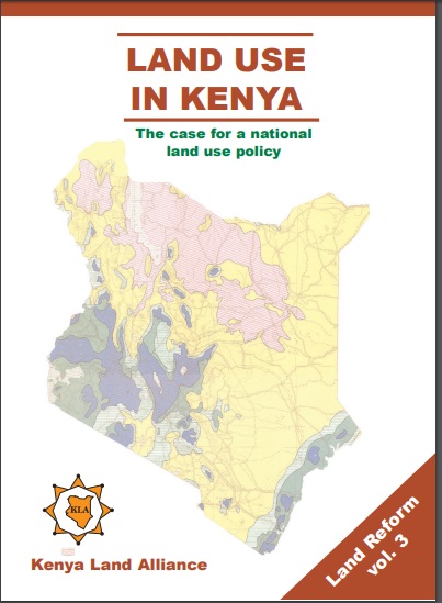
Land Use in Kenya; The case for a national land-use policy

Journal Articles & Books
February, 2015
Kenya

This book exposes the key land use and environmental problems facing Kenya today due to lack of an appropriate national land use policy. The publication details how the air is increasingly being polluted, the water systems are diminishing in quantity and deteriorating in quality. The desertification process threatens the land and its cover. The soils are being eroded leading to siltation of the ocean and lakes. The forests are being depleted with impunity thus destroying the water catchments.

LAND GOVERNANCE IN URBAN AREAS CASE OF NAIROBI CITY COUNTY

Journal Articles & Books
February, 2017
Kenya

Globalisation and urbanisation trends in developing countries present both opportunities for growth and development on one hand while contributing to the complex myriad challenges of managing urbanisation on the other hand. Cities and urban areas play a critical in the development of a country. They provide platforms that incorporate intense combination of economic, cultural and political factors of a country or region. Nairobi city is Kenya’s economic capital and is a major economic hub in Africa.

The Structure of Cadastral System in Kenya

Journal Articles & Books
May, 2013
Africa
Kenya

The cadastral system2 in Kenya was established in 1903 to cater for land alienation for the white settlers. Since then, a hundred years later, the structure of the system has remained more or less the same despite major changes in surveying technology. The government of Kenya has realized that the current structure is not conducive to economic demands of the 21st century and is interested in re-organizing the structure in line with the current constitutional dispensation and new paradigms in land management.

Urban Land Use Planning Monitoring And Oversight Guidelines

Manuals & Guidelines
November, 2016
Kenya

Cities and Urban Areas play a crucial role as engines of development as well as centers of connectivity, creativity, innovation, and as service hubs for the surrounding areas. Kenya has experienced unprecedented urban growth. At independence the urban population was about 8%. This had grown to be about 40% by 2015. It is projected that by year 2030 at least half of the Kenyan population will be urbanized. The rapid rate of urbanization exerts increased pressure on authorities to meet the needs of growing urban populations.

DEVELOPING LAND INFORMATION MANAGEMENT SYSTEM (LIMS) FOR COUNTY GOVERNMENTS IN KENYA: A CASE STUDY KIRINYAGA COUNTY.

Journal Articles & Books
February, 2017
Kenya

This paper describes the development of a Land Information Management System (LIMS) for County Governments in Kenya. In the new Constitution 2010, devolution of some national government functions and formation of county governments was provided for. These invoked the development of new land laws to guide the devolution processes and procedures. According to the County Government Act 2012, all County Governments are supposed to develop digital Geographic Information System (GIS) based spatial plans and these calls for development of LIMS for and efficient breakthrough.

Using geospatial technologies to support compulsory land acquisition in Kenya

Journal Articles & Books
April, 2015
Kenya

Governments have power to compulsorily acquire land or other interest in land for a public purpose subject to prompt payment of the compensation to the affected persons. The process of land acquisition involves several government departments which have different mandates depending with the purpose of the acquisition. In several instances departments involved have been seen to be disjointed hence causing gaps and unfinished work in the whole process.

AN EVALUATION OF THE CADASTRAL SYSTEM IN KENYA AND A STRATEGY FOR ITS MODERNIZATION

Reports & Research
July, 2013
Kenya

The Cadastral system in Kenya was established in 1903 to support land alienation for the white settlers who had come into the country in the early part of the 20th Century. In the last hundred years, the system has remained more or less the same, where land records are kept in paper format and majority of operations are carried out on a manual basis. The lack of a modern cadastral system has contributed to problems in land administration in the country.

The pastoralist’s parcel: towards better land tenure recognition and climate change response in Kenya’s dry lands

Journal Articles & Books
April, 2013
Kenya

Conventional notions of the ‘land parcel’ have been extended: previously unrecognized tenures including customary, nomadic, or communal interests are now incorporated into the concept. Technical tools including the Social Tenure Domain Model (STDM) enable these new understandings to be operationalized in land administration systems. The nomadic pastoralists of Kenya’s dry land regions illustrate where these new approaches can be applied.

The Structure of the Cadastral System in Kenya

Journal Articles & Books
June, 2013
Kenya

The cadastral system in Kenya was established in 1903 to cater for land alienation for the white settlers. Since then, a hundred years later, the structure of the system has remained more or less the same despite major changes in surveying technology. The government of Kenya has realized that the current structure is not conducive to economic demands of the 21st century and is interested in re-organizing the structure in line with the current constitutional dispensation and new paradigms in land management.

PREPARATION AND IMPLEMENTATION OF COUNTY SPATIAL PLANS

Manuals & Guidelines
January, 2017
Kenya

The Constitution of Kenya 2010 apportions responsibility of planning to both National and County governments. The County Government Act, 2012 obligates county governments to prepare and implement County Integrated Development Plans (CIDP). The CIDPs are, according to the act, five year plans that will form the basis of annual budgetary allocation by the county governments.