page search

There are 1, 167 content items of different types and languages related to geographical information systems on the Land Portal.
Displaying 445 - 456 of 578

Applying Built-Up and Bare-Soil Indices from Landsat 8 to Cities in Dry Climates

Peer-reviewed publication
September, 2018
Iraq

Arid and semi-arid regions have different spectral characteristics from other climatic regions. Therefore, appropriate remotely sensed indicators of land use and land cover types need to be defined for arid and semi-arid lands, as indices developed for other climatic regions may not give plausible results in arid and semi-arid regions. For instance, the normalized difference built-up index (NDBI) and normalized difference bareness index (NDBaI) are unable to distinguish between built-up areas and bare and dry soil that surrounds many cities in dry climates.

Temporal and Spatial Analysis of Flood Occurrences in the Drainage Basin of Pinios River (Thessaly, Central Greece)

Peer-reviewed publication
September, 2018
Greece

Historic data and old topographic maps include information on historical floods and paleo-floods. This paper aims at identifying the flood hazard by using historic data in the drainage basin of Pinios (Peneus) River, in Thessaly, central Greece. For this purpose, a catalogue of historical flood events that occurred between 1979 and 2010 and old topographic maps of 1881 were used. Moreover, geomorphic parameters such as elevation, slope, aspect and slope curvature were taken into account.

Prioritizing Suitable Locations for Green Stormwater Infrastructure Based on Social Factors in Philadelphia

Peer-reviewed publication
December, 2018
United States of America

Municipalities across the United States are prioritizing green stormwater infrastructure (GSI) projects due to their potential to concurrently optimize the social, economic, and environmental benefits of the “triple bottom line”. While placement of these features is often based on biophysical variables regarding the natural and built environments, highly urbanized areas often exhibit either limited data or minimal variability in these characteristics.

Agricultural Expansion in the Brazilian Cerrado: Increased Soil and Nutrient Losses and Decreased Agricultural Productivity

Peer-reviewed publication
January, 2019
Brazil

While food and nutrition security are issues that national and international organizations are tackling, one of the central problems often overlooked is the essential role of soils in providing nutritious food. Soils are the base for food production and food security. However, the majority of soils are in fair and poor conditions, with the most significant threats being erosion and loss of nutrients.

Classifying and Mapping Periurban Areas of Rapidly Growing Medium-Sized Sub-Saharan African Cities: A Multi-Method Approach Applied to Tamale, Ghana

Peer-reviewed publication
February, 2019
Africa
Ghana

Periurban areas of growing cities in developing countries have been conceptualised as highly dynamic landscapes characterised by a mixture of socioeconomic structures, land uses and functions. While the body of conceptual literature on periurban areas has significantly increased over the past two decades, methods for operationalising these multi-dimensional concepts are rather limited. Yet, information about the location and areal extent of periurban areas is needed for integrated planning in the urban–rural interface.

Multi-Criteria Decision Analysis for the Land Evaluation of Potential Agricultural Land Use Types in a Hilly Area of Central Vietnam

Peer-reviewed publication
June, 2019
Global

Land evaluation is a process that is aimed at the sustainable development of agricultural production in rural areas, especially in developing countries. Therefore, land evaluation involves many aspects of natural conditions, economic, and social issues. This research was conducted in a hilly region of Central Vietnam to assess the land suitability of potential agricultural land use types that are based on scientific and local knowledge.

Detection of Urban Development in Uyo (Nigeria) Using Remote Sensing

Peer-reviewed publication
June, 2019
Nigeria

Uyo is one of the fastest-growing cities in Nigeria. In recent years, there has been a widespread change in land use, yet to date, there is no thorough mapping of vegetation change across the area. This study focuses on land use change, urban development, and the driving forces behind natural vegetation loss in Uyo.

Land-Use and Land-Cover (LULC) Change Detection in Wami River Basin, Tanzania

Peer-reviewed publication
September, 2019
Tanzania

Anthropogenic activities have substantially changed natural landscapes, especially in regions which are extremely affected by population growth and climate change such as East African countries. Understanding the patterns of land-use and land-cover (LULC) change is important for efficient environmental management, including effective water management practice. Using remote sensing techniques and geographic information systems (GIS), this study focused on changes in LULC patterns of the upstream and downstream Wami River Basin over 16 years.

Using Farmer Decision Rules for Mapping Historical Land Use Change Patterns from 1954 to 2007 in Rural Northwestern Vietnam

Peer-reviewed publication
September, 2019
Vietnam

The present study revealed how local socioecological knowledge elucidated during participatory rural appraisals and historical remote sensing data can be combined for analyzing land use change patterns from 1954 to 2007 in northwestern Vietnam. The developed approach integrated farmer decision rules on cropping preferences and location, visual and supervised classification methods, and qualitative information obtained during various forms of participatory appraisals.

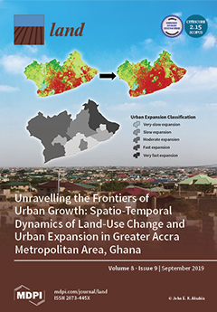
Unravelling the Frontiers of Urban Growth: Spatio-Temporal Dynamics of Land-Use Change and Urban Expansion in Greater Accra Metropolitan Area, Ghana

Peer-reviewed publication
September, 2019
Ghana

This study analyzed and assessed spatio-temporal dynamics of land-use change (LUC) and urban expansion (UE) within the Greater Accra Metropolitan Area (GAMA) of Ghana. This region serves as a case to illustrate how a major economic hub and political core area is experiencing massive spatial transformations, resulting in uneven geographies of urban land expansion. Quickbird/Worldview-2 images for the years 2008 and 2017 were segmented and classified to produce LUC maps. LUC and UE were analyzed by post-classification change detection and spatial metrics, respectively.

How Much is Enough? Improving Participatory Mapping Using Area Rarefaction Curves

Peer-reviewed publication
November, 2019
Philippines

Participatory mapping is a valuable approach for documenting the influence of human activities on species, ecosystems, and ecosystem services, as well as the variability of human activities over space and time. This method is particularly valuable in data-poor systems; however, there has never been a systematic approach for identifying the total number of respondents necessary to map the entire spatial extent of a particular human activity. Here, we develop a new technique for identifying sufficient respondent sample sizes for participatory mapping by adapting species rarefaction curves.