land information systems | Land Portal

Latest news

Scenes from Chewe village
4 July 2023
Zambia
Botswana

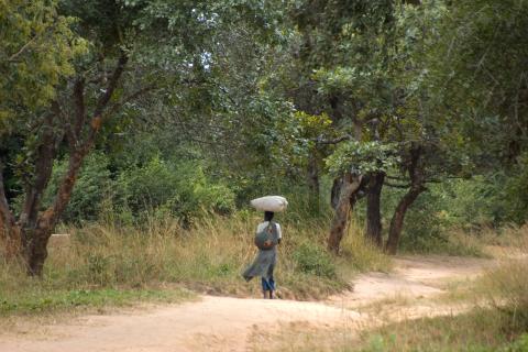
Two comprehensive State of Land Information (SOLI) reports have been released, providing in-depth assessments of the land data and information ecosystems in Botswana and Zambia. These reports examine the availability of land information and evaluate its compliance with open data standards. The findings highlight the strengths and weaknesses of each country's land information management practices and offer insights for targeted interventions.

Cadasta Foundation Launches New Global Land Rights Challenge Fund to Secure Land and Resource Rights
5 November 2019
Global

Cadasta Foundation has launched its new Global Land Rights Challenge Fund to help partners better leverage Cadasta’s innovative tools and services to document land and resource rights worldwide.


Blogs

Events

Library

Organizations

Independent platform for registering and administering legally-acquired use and benefit rights over land in Mozambique

The National Institute of Statistics (NIS), which is part of the Ministry of Planning, is the focal point on statistical matters in Cambodia. The NIS compiles and consolidates statistics provided by decentralized offices and also collects primary data through household and establishment surveys and population, agricultural and economic censuses. Many development partners financially and technically assisted NIS since 1993.


MOTTO

The Dedan Kimathi University of Technology motto is: “Better Life through Technology”.


VISION STATEMENT

To be a Premier Technological University Excelling in Quality Education, Research, and Technology Transfer for National Development.


MISSION STATEMENT

 European Space Agency logo

The European Space Agency (ESA) is Europe’s gateway to space. Its mission is to shape the development of Europe’s space capability and ensure that investment in space continues to deliver benefits to the citizens of Europe and the world.

ESA is an international organisation with 22 Member States. By coordinating the financial and intellectual resources of its members, it can undertake programmes and activities far beyond the scope of any single European country.

What does ESA do?

Geomatics, Landmanagement and Landscape

By the decision of the authorities of the Department of Environmental Engineering and Geodesy at the University of Agriculture in Krakow of 17 October 2012 a scientific quarterly magazine named Geomatics, Landmanagement and Landscape (GLL) was created.

The purpose of the quarterly magazine are presentations, discussions and exchange of scientific thoughts in the field of broadly understood planning, shaping and protection of the environment and landscapes; modern geoinformatic techniques, surveying, rural areas development and property management.

The Global Data Barometer is a collaborative project that aims to measure the state of data in relation to urgent societal issues.  Together with regional hubs and thematic partners, we seek to appraise data availability, governance, capability and use around the world to help shape data infrastructures that limit risks and harms in climate action, company information, health and COVID-19, land, political integrity, public finance and public procurement.

GODAN supports the proactive sharing of open data to make information about agriculture and nutrition available, accessible and usable to deal with the urgent challenge of ensuring world food security.  It is a rapidly growing group, currently with over 317 partners from national governments, non-governmental, international and private sector organisations that have committed to a joint Statement of Purpose.


Guyana Lands and Surveys Commission

Vision Statement

By 2010, the GLSC will become a self-sustaining organization through a team of professional and motivated staff, use appropriate technology to deliver quality services to its clients, provide decision support for effective land management, policy and planning, and ensure access to land to land by all, thus contributing to poverty alleviation and National Development.

International Journal of Engineering & Technology

The aim of the International Journa l of Engineering &Technology (IJET) (ISSN 2227-524X) is to provide fast publication of refereed, high quality original research papers in all areas of engineering and technology. The journal covers following disciplines:

KDNG is a network of Kachin civil society groups and development organizations inside Kachin State and abroad. It was in September 2004.


KDNG promotes the formation of a healthy civil society based on equality and justice for local people. It works to document the military government's exploitation of natural resources, collecting information large scale development including mining, mono crop plantation and hydropower.


There are 495 content items of different types and languages related to land information systems on the Land Portal.

A Land Information System is a tool for legal, administrative and economic decision-making and an aid for planning and development. A land information system consists, on the one hand, of a database containing spatially referenced land-related data for a defined area and, on the other, of procedures and techniques for the systematic collection, updating, processing and distribution of the data. The base of a land information system is a uniform spatial referencing system, which also simplifies the linking of data within the system with other land-related data.
 

Source: Land administration guidelines with special reference to countries in transition (United Nations Economic Commission for Europe). ISBN 9211166446

Share this page