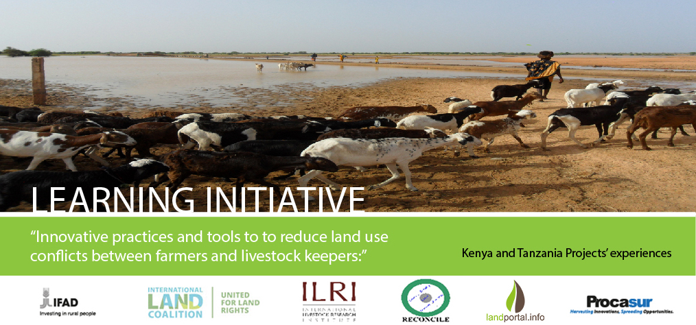

The PROCASUR Corporation in Africa in collaboration with the International Fund for Agricultural Development (IFAD) have partnered with the International Land Coalition, International Livestock Research Institute (ILRI), the Land Portal Foundation and Resource Conflict Institute (RECONCILE) to present the Learning Initiative: Innovative practices and tools to reduce land use conflicts between farmers and livestock keepers, taking place in Kenya and Tanzania, between the 22nd September and 1st October 2017 under the framework of the PROCASUR-IFAD Programme “Strengthening Capacities and tools to scale up and disseminate Innovations.
Through a face-to-face learning, the 10-day Learning Route includes the opportunity of learning directly in the field and from its protagonists some of the best practices, innovative tools and approaches implemented in favour of land use conflict resolution among farmers and livestock users. Participants are drawn from IFAD, government partners and CSOs working in pastoral areas of Nigeria.
The Main objective of this cross-regional learning initiative is to contribute to lesson-sharing and learning at country and regional level in order to build technical capacities within IFAD´s operations and main partners in the Africa region on innovative strategies of securing land rights and how to manage land conflicts between farmers and pastoralists.
Daily accounts of the Learning Route will be posted here on the Land Portal website including the summary of the experiences and places visited, and feedback from the participants and resources persons they meet along the way. Please join us each day to follow their progress.
Watch this video to see a previous experience of a Learning Route in Kenya and Tanzania organised by the ILC Rangelands Initiative. You Tube:https://www.youtube.com/watch?v=JkVRgfxTLBw


Comments
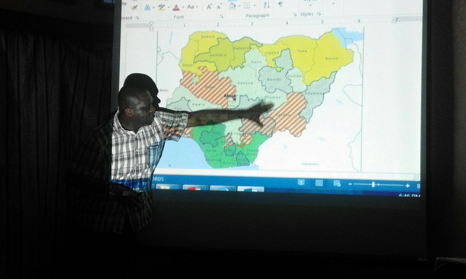
Today the 25 participants of the Learning Route are departing from Nigeria to Nairobi to commence their journey. The participants come from 10 different states of Nigeria. Most of the group are are key actors and stakeholders in the IFAD Value Chain Development Project (VCDP) including the Honorable Commissioners for Agriculture, State Programme Coordinators and Agriculture Production officers, and IFAD staff from six States involved by the VCDP including IFAD’s Country Program Manager. In addition there are three civil-society and development-focussed participants who have had had a long history in advocating for pastoralist rights in the country. Key actors from government in Tanzania and Kenya will also join the Route at appropriate points to contribute to and learn from the multi-country policy dialogues experiences.
The pastoral Fulani people of Nigeria – also known as Peul, Fulbe, Fula are believed to be the world's largest semi-nomadic ethnic group. Conflicts between them and farmers in Nigeria have been escalating since 2011. They have cost lives and displaced people. Increasing competition for land and resources and a failure to resolve underlying causes of conflicts such as a lack of investment in the livestock sector and poor land use planning, has meant clashes arise on an almost daily basis. The federal government’s response to the crisis has been widely criticized as inadequate. According to the UK-based humanitarian organization, Mercy Corps, the conflict has cost Africa's largest economy more than $14bn (£10bn) in the three years to 2015.
For those working in areas where such conflicts are occurring, there is disruption to project activities and danger from being caught in the cross-fire. IFAD-Nigeria and partners participating in the Learning Route hope that during their visit to Kenya and Tanzania they will identify some innovations for addressing the causes of the conflicts and solutions to them.
“My expectation of the Learning Route is to see and share experiences for a system that works better to minimise land user conflicts, especially the farmers-herdsmen clashes occurring in most states in Nigeria today.” David Ishaya, High Commissioner for Agriculture, State Ministry of Agriculture, Taraba State, Nigeria.
“I want to specifically explore the possibility of adopting the innovative practices and tools to reduce land use conflicts between farmers and herdsmen challenge in Nigeria. I am also hoping the Learning Route will give me the opportunity to engage in a balanced discussion with stakeholders, share experiences, establish networking and develop road map to a sustainable pastoralism in Nigeria.” Rilwanu Muhammed Faralu, General Manager, Community and Social Development Project, Katsina State, Nigeria.
“I expect to learn how pastoralists and farmers share on sustainable bases common property resources, maintain peaceful and harmonious coexistence as well as the key roles played by actors in the process.” Ardo Umar Faralu, Project Coordinator, National Commission for Nomadic Education, Katsina State, Nigeria.
More information on the journey and the case studies can be found here: http://africa.procasur.org/index.php/our-work/lr-sorted-by-year/item/262...
Watch this video to see a previous experience of a Learning Route in Kenya and Tanzania organised by the ILC Rangelands Initiative. You Tube:
This first day of the Learning Route kicked-off with an Introductory Workshop and Panel Discussion in Nairobi, in order to provide the participants with a good contextual background on Kenya for the experiences they will see and hear about over the next few days. The Workshop was opened and the participants welcomed by Mr Ernest Mbogo, Range Management Division, Ministry of Agriculture, Livestock and Fisheries, and Mr Joseph Jamus, Regional Coordinator for the International Land Coalition Africa regional platform.
A panel of Kenya rangeland experts provided some contextual information on the policy and legislative environment, challenges including conflicts over land use, and tools and processes underway to resolve these. Charles Konyango, Assistant Director of Planning for the National Land Commission described how Kenya has adopted appropriate land use policies and land use planning at different levels including County Spatial Planning to resolve and prevent conflicts, address livelihood zones management and, to provide alternatives for self-sustenance. The policies aim at reforming rather than ‘modernizing’ the livelihood systems and balancing of various competing land uses. The next presentation was provided by Lance Robinson, Senior Scientist, at ILRI (International Livestock Research Institute), describing some of the work of ILRI on identifying the most appropriate governance structures and processes including land use planning. This has included a review of different local initiatives as well as to work with counties in the country on implementing land use planning in rangelands.
In the afternoon the participants discussed the process of developing Innovation Plans – each participant is expected to produce an Innovation Plan drawing from their experience and things they have learnt during the Route, and which they will put into action on their return to Nigeria.
Mr. Ernest Mbogo, Ministry of Agriculture and Livestock Welcoming Participants
Mr. James Mbika, IFAD Kenya Country Program Manager Welcoming Participants
Today the participants travel to Olkirimatian Group Ranch. The Ranch is located in the northwest part of Magadi Sub-county in Kajiado County in southern Kenya. The Olkiramatian Group Ranch covers an area of 22,000 acres and hosts a population of approximately 15.000 predominantly Maasai livestock keepers.
In the late 1960s the Kenyan Group (Representatives) Act created exclusive land ownership and rights among groups of Maasai residing within an identified area. A land title was issued to each group, formalising its collective rights to the land through the “group ranches” system, which was aimed at privatising Maasai land and reduce further encroachment and appropriation. However over time the group ranch system experienced gradual privatisation of the land including subdivisions, sales and leasings. This has resulted in a loss of key grazing areas, blockage of migration routes and negative social aspects due to the privatisation of resources.
The Olkiramatian Group Ranch is a very interesting case of communal land use planning and zonification of the territory in order to reflect requirements for grazing, agriculture and conservation/tourism. It is also the only existing communally owned group ranch in the southern rangelands having not subdivided.
The case is also critical since it presents a basis for discussing the Community Land Law which was developed following the 2010 Kenya Constitution creating a new tenure regime called Community Land. In 2016 September, a new law Community Land law was enacted, which once implemented will incorporate all community lands including the remaining group ranches.
In response to the learning objectives the main lessons to be learned from the Olkiramatian case include:
• Systems that build community economy and group cohesion - the importance of adopting a strategic and multifunctional use of land, by diversifying income generating activities in the territory, even maintaining the flexibility of movements and choices as a means to building group cohesion;
• Proper and functional local structures and governance framework- the importance of establishing a local governance system based on a good combination of traditional authorities and formal group ranch institutions, both collaborating for the communal management of the land;
• Alliances and partnership building - the importance of establishing an extensive network of collaboration including stakeholders and actors at multiple level, in order to get support for the security.
“Over 30% of Masai land has been sold in the country: there are many external pressures from people who want to buy lands, families have sold their land from group ranches to individuals, they put fences and animals cannot move freely in the territory, it becomes impossible to keep livestock. It forces people to change, they lose their identity, their dignity. This is a tragedy of our time!” John Kamanga, Chairman of Olkirimatian Group Ranch.
Participants visiting Olkiramatian group ranch
Member of Olkiramatian group showing participants conservation zone
Olkiramatian group ranch explaining the map and zonification of the group ranch
Today the group visited the different land use zones of Olkirimatian Group Ranch. The community has divided up the ranch into three major zones – the Conservation Zone, the Agricultural Zone and the Grazing Zone (with both wet and dry season grazing).
Community drawn map of Olkirimatian Group Ranch showing different land use zones
The livestock zone covers the largest portion of the territory. In this zone the Maasai established most of their settlements and bomas (Masai livestock enclosures). The grazing area is communally managed, and the livestock is not allowed to be moved from this zone without the permission of the local grazing committee. In this area there is a weekly livestock market.
The agricultural zone is the main area use for cultivation. The Ranch is blessed with permanent rivers flowing through this part, from which irrigation channels have been dug to provide water for food crops including vegetables, eggplants, okra, maize, beans, and different species of fruits. The cultivation area has been subdivided into individual plots of land distributed amongst the members of the ranch and managed by households. The average size of these plots is 8 acres. Some people have also taken up fish farming.
Photo: Mango trees growing in the agricultural zone of the Ranch
The third area is the conservation area. Established in 2003 its aim is to conserve wildlife as well as make money from the wildlife and the area through tourism. A lodge has been built in the area, as well as a Research Centre that is managed by the women’s organization of the community (we will talk more about this tomorrow). No permanent human settlement is allowed within the conservation zone. In the dry season of two months livestock is allowed to graze here in a managed way, and in normal times keeping the core conservation only for wildlife. This access is strictly managed by the Conservation Committee, including community rangers.
Photo: Sampu Camp is leased out to a tour operator for extra revenue
The Olkiramatian Women’s Group was established in November 2007 and there are currently 170 members. A chairlady and thirteen committee members have been elected. Membership dues are required with registration, which add to the new organization’s accruing revenue. After a research site was chosen, the Olkiramatian Women’s Group was given legal ownership of the land. This way the camping fees collected from researchers and educational groups could be put back into the community through various programs which they are still developing. A partnership was made between the Group Ranch and the African Conservation Centre. The women invest the money raised in other income-generation activities such beadwork to sell to the national and international research groups that visit the Centre. They would also like to set up bursaries for girls in the community and see the Resource Centre develop into a meeting ground and educational centre for the whole community: they are now seeking support from outside the community about training in business management.
Photo: The women of Olkirimatian Group Ranch manage a Research Centre and make intricate beadwork
Today later afternoon in the group reached Tanzania. Over the next few days the group will be learning about the policy and legislative environment, whilst visiting different organisations and initiatives making rangelands more secure for local rangeland users.
In Tanzania, the Village Land Act No. 5 of 1999 (VLA) and the Land Use Planning Act No. 6 of 2007 (LUP Act) guide planning at the local level. The VLA (sections 12 and 13) grants power to Village Councils (VCs) and their institutions to prepare participatory village land use plans (VLUPs). The LUP Act (sections 18, 22, 33, and 35) provides for the formation of planning authorities, functions, and procedures of developing participatory VLUPs and approval processes, and grants power to VCs to prepare those plans.
The Tanzania National Land Use Planning Commission’s Guidelines for Village Land Use Planning, Administration and Management (the NLUPC Guidelines – April 2013 revised version) detail six main steps to follow when developing participatory VLUPs. Despite this guidance, limited resources mean that village land use planning rarely gets beyond Step 4 of six, and support for the actual implementation of plans is lacking or extremely limited.
Village land use planning in rangelands faces particular challenges. Lands held by individual villages are generally not sufficient to sustain rangeland production systems such as pastoralism, and so demand a sharing of resources across village boundaries. There is low awareness on land use planning amongst district governments and communities, and conflicts over boundaries are common. Conventional land use planning tends to limit the mobility of pastoralists and others such as hunter- gatherers, whereas the semi-arid and arid environment of these areas demands that this mobility is retained.
In Arusha the Learning Route participants are being hosted by UCRT (the Ujaama Community Resource Team). UCRT is a non-profit environmental and social justice organization, whose vision is: “Strengthened livelihoods and social justice for pastoralist, hunter-gatherer and agro pastoralist communities through security over land and natural resources, and sustainable community-based natural resource management.” UCRT develops its activities in many districts in the Northern Tanzania, an area where there is a crossroad of different cultures and indigenous peoples with ancient heritage and UCRT works in support of hunter-gatherers and pastoralists communities inhabiting these areas. Some of the main indigenous peoples which have benefited from UCRT work are: the Hadzabe (ancient hunter- gatherers), the Iraqw (agro-pastoralists), the Maasai and Barabaig (semi-nomadic pastoralists); the Bantu speaking Sonjo (hunter gatherers), the Akie (hunters-gatherers). UCRT has developed several innovations that are enabled by Tanznia’s policy and legislation promoting governance for inclusiveness and representativeness at every decision- making level; by using several conflicts management approaches and tools such as the mobility agreements and the group Certificate of Customary Right of Occupancy (CCRO). This morning UCRT made a presentation of their work.
Photo: Edward Loure of UCRT presenting the main reasons and consequences of conflicts in northern Tanzania and how UCRT supports peaceful resolutions
Photo: Edward Lekaita of UCRT presenting the legal framework on land tenure in Tanzania
Photo: Zakari Faustin, Acting Director of the Tanzania Natural Resource Forum describing the different steps in the national land use planning process, used for village land use planning and securing rights to group grazing and individual lands
Their time in Arusha has given the Learning Route participants some time to reflect and consider their experiences so far on their journey. Listen to these two accounts:
Emmanuel Igbaukume, Benue State Programme Coordinator, Nigeria
Part 1: James Ekoja, Agricultural Production Officer, Value Chain Development Officer, IFAD-Nigeria
Part 2: James Ekoja, Agricultural Production Officer, Value Chain Development Officer, IFAD-Nigeria
This afternoon the participants arrived in Kiteto District. Kiteto District is the site of the piloting of the process of joint village land use planning, that has been developed by the Sustainable Rangeland Management Project (SRMP). Between 2010-2015 SRMP assisted nine villages to carry out village land use planning, and successfully piloted the implementation of joint village planning across three of these, leading to the protection through certification of a shared grazing area called OLENGAPA, found in Kiteto District, Manyara Region.
SRMP has now entered its third phase (2016-2020) with the financial support of IFAD, Irish Aid, the International Land Coalition, ILRI, and the Government of Tanzania. This phase focuses on the scaling-up of the joint village land use planning approach in several new clusters of villages, as well as expanding the original ones. This includes the securing of grazing areas through the provision of CCROs and improving the management of the areas by the established Livestock Keepers Associations through action research on such as rangeland rehabilitation, and improvement and intensification of rangeland and livestock productivity.
Activities will be undertaken in three regions – Manyara, Morogoro and Pwani. The locations of the new clusters of villages appropriate for joint village land use planning will be identified through a mapping of grazing areas, livestock routes, and VLUP interventions across a pastoral-dominated landscape or corridor stretching form Kiteto district (in Manyara region), through Kilindi district (Tanga region), Mvomero distirct (Morogoro) and up to Bagamoyo district in Pwani region.
Project management and implementation
The Ministry of Agriculture, Livestock and Fisheries (MALF), the National Land Use Planning Commission (NLUPC) and ILRI (International Livestock Research Institute) jointly implement the Project. National CSOs support communities and District Councils to plan and secure grazing areas in the village clusters. Regional government and technical experts from partners advise and guide the Project through a National Technical Working Group coordinated by the MALF.
Photo: Staff from IFAD, International Land Coalition and ILRI discussing with local pastoralist communities about land use conflicts in Bagamoyo – one of the intervention areas of SRMP Phase III
The joint land use planning process in Kiteto district, Manyara Region began in November 2013, and included the villages of Lerug, Ngapapa, and Olkitikiti. The three villages share boundaries and grazing resources, and In order to illustrate a single shared identity across the village boundaries the name OLENGAPA was chosen, incorporating a part of each village’s name.
The total area of the three villages is 59,007.5 hectares. The majority of inhabitants are Maasai pastoralists with some Ndorobo hunter-gatherers, and some farmers most of whom are seasonal migrants. Mobility is central to the survival of the pastoralists and takes place across the three villages, as well as beyond to places in Kilindi, Gairo, and Bagamoyo districts.
Average annual rainfall is between 800-1,000mm per annum. There are no permanent rivers flowing through the OLENGAPA villages. The only permanent and dependable surface water source is Orkitikiti Dam, constructed in 1954.
In order to understand the different resources in the villages and their distribution, SRMP supported the villagers to carry out a participatory mapping of these. This was used to develop a basemap for the village land use planning process, including showing which resources are shared by the villages and where they are situated.
Photo: The SRMP has introduced participatory mapping of resources into the village land use planning process
SRMP then facilitated village members to come to agreement over the individual village land use maps and plans, as well as the joint village land use map and plan, and the joint village land use agreement (JVLUA). These detailed and ultimately protected the shared grazing area, water points, livestock routes and other shared resources. Reaching agreement was a protracted negotiation process between the villages and within villages between different interest groups, involving many community meetings and much investment of resources. In the end each Village Assembly approved the JVLUA, which allocated 20,706.73 ha of land for shared grazing – that is, around 40% of the total area of the villages. By-laws for the management of the resources were developed and adopted.
Following on from the approval of the JVLUA, the three OLENGAPA Village Councils established a Joint Grazing Land Committee made up of members from all three villages. This Committee is responsible for planning, management, enforcement of by-laws applicable to the OLENGAPA, and coordination of the implementation of the OLENGAPA land use agreements and joint land use plan. In addition a Livestock Keepers Association was established including 53 founding members with most households from the three villages being associate members. A constitution was developed for the Association, and the Association was officially registered on 11 September 2015.
Photo: Map of the shared grazing area in OLENGAPA crossing the three villages
In January 2016 the Ministry of Lands approved and registered the village land boundary maps and deed plans for the three villages. The District Council has issued the village land certificates and the next step is for Village Councils to begin issuing CCROs. The shared grazing area will require three group CCROs to be issued to the Livestock Keepers Association – one from each village for the part of the grazing area that falls under its jurisdiction. Signboards and beacons marking the boundary of the shared grazing area are being put in place.
Today the participants visited the OLENGAPA community, and their villages.
Photo 1: Grazing Committee members of the OLENGAPA Livestock Keepers' Association
Photo 2: The Olktikiti Dam – a key resource shared by the three villages of OLENGAPA plus neighbouring ones.
Some thoughts from the participants:
I have found the learning route quite interesting. What has fascinated me most in the first case study is the participatory approach in resource management and its positive impact in reducing conflict.
Adogun Samuel Babatunde, State Programme Coordinator,
The Learning Initiative has been both educating eye opener and adventurous as well.
1. We visited communities that are unique in some sense to the theme but differs in the implementation of the tools though in similar settings. Three villages jointly achieved peace through the Village Participatory Land Use Planning i.e. in Olenaapa. This is a good case for Nigeria to emulate but to meet up we need to extend the joint PLUP to States to suite our current situation. Olengapa approach impressed me very much especially the short drama depicting the PLUP processes from individual communities at village levels to the joint village level with the support and moderation by the local authorities.
2. It is possible to apply PLUP in Nigeria to address boundary disputes, farmers/herdsmen conflicts and resource use conflicts within and between villages. But the scale of the conflicts in Nigeria is beyond villages and involving States and ecological areas. On the whole PLUP can be applied in Nigeria as the base. Security and cattle rustling was not adequately covered by the case study though central to the conflicts in most affected States of Nigeria. With mentoring and other support we can try it in the villages surrounding the Rangelands in Katsina State, Nigeria.
Rilwanu Zango, General Manager, Community and Social Development Project, Katsina State
60% of my expectations have been met so far, the group ranching in Olkiramatian in Kenya and the Ujamaa community resources management in Tanzania are wonderful innovations I have learnt. It is very clear that the culture of the people are respected and in all the two communities there are laws guiding the use of the resources which penalties are clearly stated and respected by all the users also dialogue and negotiation are used in resolving conflicts. I intend to go back and replicate some of the innovations back home through stakeholders engagement and sensitization.
Emmanuel Igbaukum, State Program Coordinator, Benue IFAD VCDP
UCRT is a well-organized and focussed centre. Their achievements are great. However, they need to do more to empower their rural women, give the women a sense of belonging in the household set up and community.
Musa Dalang Rural Institution, Gender and Youth Development Specialist.
1. The learning route has provided me a chance to meet top government officials that influence decisions that
can lead to peaceful co-existence between pastoralists and farmer;
2. Two very important as aspect of the trip was the land mapping and joint land use process;
3. Active community participation in decision-making was practically demonstrated and appreciated;
4. The initiative has provided two potential intervention opportunities in Nigeria to reduce the conflicts.
Attahiru Alhassan Jaoji, Coordinator of the Confederation of Traditional Herders Organisations (CORET)
The meeting followed until night and ended with the presentation by CPO in Nigeria.
Today the participants are working hard on their innovation plans. The participants are clustered into groups and working together to develop plans for action when they return home and to the work. Plans include actions to pilot the use of participatory mapping, developing dialogue platforms between farmers and herders, the mapping of livestock routes and understanding where pastoralists and livestock using those routes are coming from, and developing ideas for local level land use planning
Working groups on innovation plans
Participants working into the night developing their innovation plans
After a technical wrap-up by Ken Otieno of RECONCILE – Kenya (and coordinator of the ILC Rangelands Initiative Africa), the participants shared their innovation plans – these will form the foundation of how they transfer the lessons learned from the experience back to Nigeria and the work and activities that they are supporting. The key objective of these innovation plans was to reduce conflicts between herders and farmers.
The participants showed appreciation for the opportunities that the Learning Route presented, not only in terms of learning from the experiences of Kenya and Tanzania but also in developing relations and linkages with people and organisations that they would not normally have had contact with. This included within the participants themselves and the linkages developed between the State Commissioners and other government representatives, the project staff, and the CSOs. All agreed that this partnership will be built on once the group return to Nigeria, and dialogue and action continues on how the conflicts between herders and farmers can be resolved.
Photo: Ken otieno making a technical wrap-up
Photo(s): Participants presenting their innovation plans
Photo: The trip closed with a ceremony and handing out of certificates
There is a long tradition of land ownership and the distribution of land rights. Although the land is thought to be a gift of nature and therefore of the necessity in providing an equality of the opportunity for its use, to everybody capable of working it, in practice the land is owned by a relatively small proportion of the population, who tend to monopolize its economic advantages.
When the land first comes into use, and in particular when national organizations try to distribute it more evenly, ownership of the various sites or plots of land will be spread between all of the farming families in the region, and each of them initially will have about the same opportunity to make good use of it. Even though some is more fertile, better watered or easier to work, allowances can be made so that depending on the sizes of the working parts of each family group, roughly the same potential productivity is provided for each.
This is an idel situation, and it is unlikely that these opportunities are distributed in this way. But even if this is done in an ideal way at the beginning, it is not long before some families become dissatisfied with their situation compared to their neighbors. Some need more area because they graze their cattle, whilst other aim to grow crops that require better water availability than the grazers, etc.
It gets even more complicated when one farmer sells his land to another because his children have left home for the city and the (unwise) farmer prefers to spend the money from his sale, compared to the difficulty in getting good help in making proper use of his ground. So after a few years we have a situatiion of uneven distribution of the potential use of the land, with some of it not being properly used and certain poorer families not owning suitable amounts of land (or any) to satisfy their needs.
The point I am making is that the happy ideal of equal distribution of potential land use (opportunity) soon fails to work out. After a few years we have created land monopolists, who are retaining some land unused so as to subsequently speculate in its growing value (which increases as the infrastructure of the region is improved) and the land becomes more productive and accessible etc. This situation is clearly unjust from a social ethical viewpoint, yet it is so common in many countries, in both rural and urban situations, that it should be clear that the principle of private land ownership is basically wrong.
Of course part of this Land Portal website expression favours the idea to distribute the land that has previously been controlled (or even owned) by a smaller number of beneficeries, to more of the population. However, no matter what proportion of them begin as new land owners and workers of it, after some time there is a strong tendency for the land to be monopolized by smaller numbers of the people and for those who are landless and seek work on other sites (which they don't own), to receive little in the way of wages. This situation creates different classes of people, some of whom suffer the poverty of not being able to find properly paid jobs. This is true in "new" countries no less that in highly developed "western" ones.
In order to continue to provide an equality of opportunity for both earning power and residence, not only should the infrastructure be built up from public funds, but the benefit of land ownership should be better shared. This is possible when the land access rights are not shared out for individual use but when its potential benefit, of which the right of access to it provides, should be shared between the land user (in the produce in the form of his/her wages), with some going to the government for investment in the infrastructure. It is the potential value of the land being available to the land user that comprises the lease fee. This national income is in place of other kinds of taxation (which nobody likes, except the government) and which tend to fall more heavily on the lower classes. Although they pay less tax than wealthy persons, they have less purchasing power with what is left to them. Instead of paying any tax the population should be provided with access to land according to its productive capacity as rent by means of it being leased from the government. This is directly proportionate to its equivalent rent or (in other words) to its productivity and usefullness.
It is therefore proposed here that the whole business of buying and selling land and the rights of its access and use by means or registration of private ownership, be replaced by a system whereby the right of access to useful land is granted to those who pay a lease fee on a regular (possibly annual) basis. This will stop any speculation in the increasing value of the land and it will stop its being held unused, from which (competitively) the rent is driven higher by a landlord, when he/she charges a tenant for the rights of access and use.
In these theoretical and unfortunately eventual practical terms, the allocation of specific sites is not a safe way to ensure that land monopolies do not occur, and poverty and social classes do not become exaggerated (as they are today in many places) and that there is a more uniform of equality of opportunity to both live and to reside.
The aims of Land Portal are not intended to create this unfair distribution of land rights, but there is not any long-term view being shared in this website, to stop land monopolization causing poverty, and its replacement by national leasing of national land (as is done in places like Hong Kong, Estonia and Sinapore, for example). For it is only by this means that there is any real chance for the long-term elimination of poverty.