page search

Issuesland cover mappingLandLibrary Resource
There are 396 content items of different types and languages related to land cover mapping on the Land Portal.
Displaying 109 - 120 of 342

Il contesto di sviluppo del sistema CASBEE (Comprehensive Assessment System for Building Environmental Efficiency)

Peer-reviewed publication
June, 2014
Italy

Nel comparto dell’edilizia, si assiste a un enorme dispendio di energie e risorse. Ciononostante, a fronte di una crescente sensibilizzazione ai problemi dell’ambiente globale, gli operatori di questo comparto hanno individuato anche la necessità di fornire qualche contributo volto ad attenuare concretamente le problematiche ambientali. In un simile contesto, è scaturita l’esigenza di sviluppare BREEAM.

Dati aperti della pubblica amministrazione. Appunti per uno stato dell’arte nel 2016 e focus sui dati relativi al patrimonio immobiliare delle PA italiane

Peer-reviewed publication
June, 2016
Italy

Le Pubbliche Amministrazioni (PA) accumulano dati. Lo fanno per poter funzionare e per dimostrare di aver ben funzionato. La rivoluzione digitale rende trascurabile il costo di mettere a

Representing and managing Real Estate: BIM for Facility Management

Peer-reviewed publication
June, 2015
Italy

This paper is intended to explore the potential of the Building Information Modelling (BIM) methodologies to be applied to the various stages of the construction process, particularly as far as international guidelines and best practices supporting virtuous operating flows are concerned: the IT component, mostly graphic during the design phase, is mainly integrated and renewed in an alphanumeric format, and becomes an integrating part of the management and maintenance of the artefacts.

L’indennità di espropriazione di terreni soggetti a usi civici. Il caso del Livello

Peer-reviewed publication
December, 2014
Italy

L’espropriazione di beni soggetti a uso civico costituisce una fattispecie particolare dell’istituto espropriativo la cui regolamentazione, nella parte in cui coinvolge le indennità e i diritti su esse vantate, va ricercata in normative speciali molto spesso anche lontane nel tempo o in pronunce giurisprudenziali.

Land Change in the Greater Antilles between 2001 and 2010

Journal Articles & Books
July, 2017
Jamaica
Puerto Rico
Cuba
Haiti
Dominican Republic

Land change in the Greater Antilles differs markedly among countries because of varying socioeconomic histories and global influences. We assessed land change between 2001 and 2010 in municipalities (second administrative units) of Cuba, Dominican Republic, Haiti, Jamaica, and Puerto Rico. Our analysis used annual land-use/land-cover maps derived from MODIS satellite imagery to model linear change in woody vegetation, mixed-woody/plantations and agriculture/herbaceous vegetation. Using this approach, we focused on municipalities with significant change (p ? 0.05).

Indigenous Soil Classifications: What are their structure and function, and how do they compare with scientific soil classifications?

December, 1993

Focuses on two themes in the study of ethnopedology: (1) the hows and whys of indigenous soil classifications. (2) the differences and overlaps between indigenous soil classifications and western soil classifications. Aims to come to a synthesis of how to link the two sources of information to improve the success of cooperation in sustainable agricultural development.

South Sudan Land cover mapping

Institutional & promotional materials
August, 2018
Kenya
South Sudan
Sudan
Ethiopia
Uganda

The new land cover dataset will allow mapping of natural resources, human settlements and human activities in South Sudan and within neighboring countries. It will represent the most innovative and updated dataset developed for South Sudan, integrating high-resolution multi-temporal imagery, object-based image analysis

and machine-learning algorithms and LCML to support the Natural Resource Management strategy and land use planning.

Standardizing land cover mapping for tsetse and trypanosomiasis decision making

Journal Articles & Books
January, 2019
Angola
Mozambique
Egypt
Botswana
Malawi
Rwanda
Mauritania
Somalia
Uganda
Mali
Burundi
Italy
Tanzania
Sudan
Congo
Senegal
Chad
Namibia
Niger
Eritrea
Kenya

The habitat of tsetse fly (Glossina spp.) depends upon climatic conditions, host availability and land cover characteristics. In this paper, the Land Cover Classification System (LCCS), developed by the Food and Agriculture Organization (FAO) and the United Nations Environment Programme (UNEP), is proposed as a tool to harmonize land cover mapping exercises carried out in the context of tsetse and trypanosomiasis (T&T) research and control.

Reshaping the terrain: Forest landscape restoration in Uganda

Reports & Research
July, 2018
Uganda

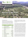
The National Forestry Authority has monitored Uganda’s land cover, including forested areas, periodically since 1990. The land cover classification is comprised of 13 classes as shown in the table below. The first five classes in the table refer to the different types of forests in Uganda. The largest forest type is woodland. Compared to other landcover types, forests are a small proportion of the country area.

Vegetation map using the object-oriented image classification with ensemble learning

Journal Articles & Books
March, 2013
Japan

Vegetation mapping provides basic information for forest management and planning. In remote sensing research, the process of creating an accurate vegetation map is an important subject. Recently, there has been growing research interest in the object-oriented image classification techniques. The object-oriented image classification consists of multi-dimensional features including object features and thus requires multi-dimensional image classification approaches.