Analyse du processus d’extension de la ville de N’Djamena au Tchad (1900 – 2018)
Journal Articles & Books
February, 2021
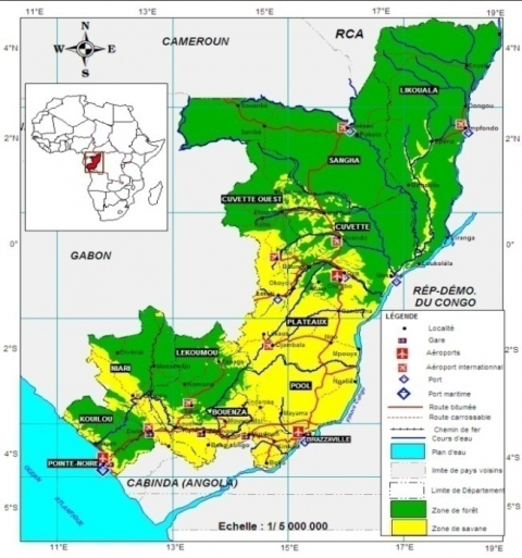
Chad
La ville de N’Djamena, capitale de la République du Tchad connaît sans cesse, depuis sa création en 1900, une extension urbaine qui se traduit par une consommation démesurée de l’espace. Un état de fait rendu possible durant des décennies par différents facteurs antagonistes issus de l’absence et/ou de l’insuffisance de l’autorité de l’Etat. Par ailleurs,d’autres facteurs contextuels s’invitent pour donner lieu à des effets irréversibles tels que: la prolifération de quartiers sousintégrés.